Soar Over the Likely Mars Landing Site of Europe's ExoMars Rover in This 3D Animation
Rosalind Franklin may explore this crater on the Red Planet.
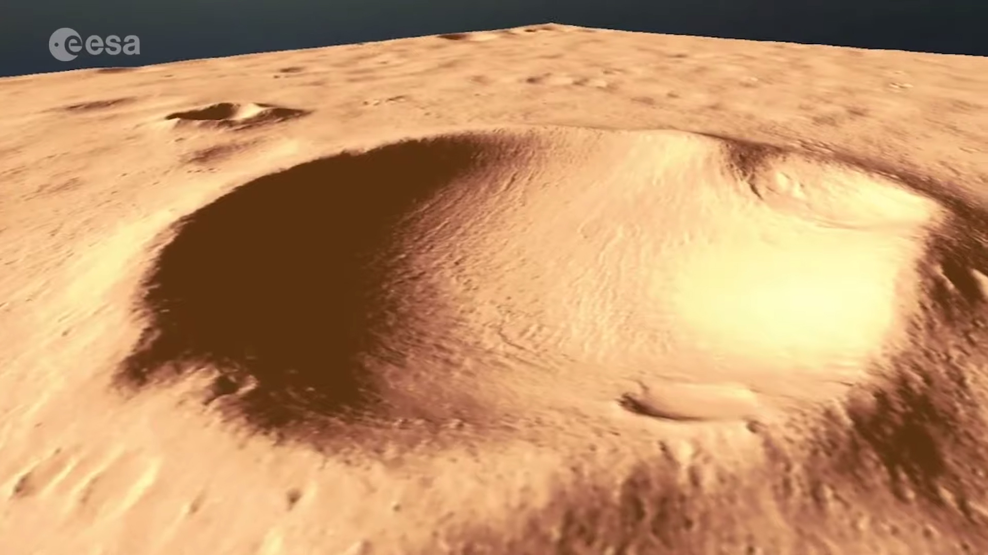
Feel like going for a spin around Mars? A new video shows a 3D view of where the European-Russian ExoMars rover may land, in a region that was likely filled with water billions of years ago.
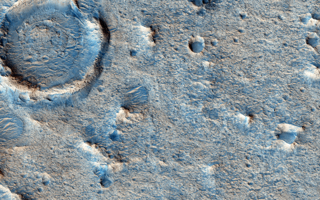
The video shows the terrain that the rover, named Rosalind Franklin, will likely drive upon after its scheduled landing in 2021. In the middle of the view is an eroded crater, luckily with flat terrain toward the center, which would give Rosalind Franklin a safe area in which to touch down and wander. The crater is located in Oxia Planum, a plain located in Mars' northern hemisphere, just southwest of Mawrth Vallis, one of the biggest valleys on Mars.
The European Space Agency explained that this region could be rich with signs of past life. Rosalind Franklin is optimized to look for signs of biosignatures, including detecting organic molecules that could have arisen from life processes.
Related: ExoMars Will Land in 1 of These 2 Spots on Mars in 2021
Video: See the ExoMars Rover's Proposed Landing Site in 3D

"Oxia Planum lies at the boundary where many channels emptied into the vast lowland plains," ESA said in a statement. "Observations from orbit show that the region exhibits layers of clay-rich minerals that were formed in wet conditions some four billion years ago, likely in a large body of standing water."
The video is based on high-resolution images from NASA's Mars Reconnaissance Orbiter, using the close-up views available from the HiRISE (High Resolution Imaging Science Experiment) camera on board. Technicians took a few steps to translate the single-dimensional pictures into a 3D-rich video.

First, they took the raw images and combined them to form "stereo" images, which are a combination of two images that were taken of the same region but from slightly different angles. This produces an interim, 3D image. In flat regions such as Oxia Planum, however, the result is not very three dimensional.
Get the Space.com Newsletter
Breaking space news, the latest updates on rocket launches, skywatching events and more!
So scientists at TU Dortmund University in Germany used a technique called "shape from shading," which involves translating the intensity of light reflected off the Martian surface into information about the surface slopes, ESA explained. The resulting 3D image provides a better estimate of the landing zone, even showing off small terrain differences in dune ripples.
These models were presented at the European Planetary Science Congress-Division for Planetary Sciences joint meeting in Geneva on Monday (Sept. 16).
- Europe's ExoMars Missions to Mars in Pictures
- Fly Over the Landing Site of NASA's Next Mars Rover (Video)
- Europe's Mars Rover Rosalind Franklin Begins Big Tests for Red Planet
Follow Elizabeth Howell on Twitter @howellspace. Follow us on Twitter @Spacedotcom and on Facebook.
Join our Space Forums to keep talking space on the latest missions, night sky and more! And if you have a news tip, correction or comment, let us know at: community@space.com.

Elizabeth Howell (she/her), Ph.D., was a staff writer in the spaceflight channel between 2022 and 2024 specializing in Canadian space news. She was contributing writer for Space.com for 10 years from 2012 to 2024. Elizabeth's reporting includes multiple exclusives with the White House, leading world coverage about a lost-and-found space tomato on the International Space Station, witnessing five human spaceflight launches on two continents, flying parabolic, working inside a spacesuit, and participating in a simulated Mars mission. Her latest book, "Why Am I Taller?" (ECW Press, 2022) is co-written with astronaut Dave Williams.
