Hurricane Irene Photos From Space
Hurricane Irene From Space Station - Aug. 26, 2011
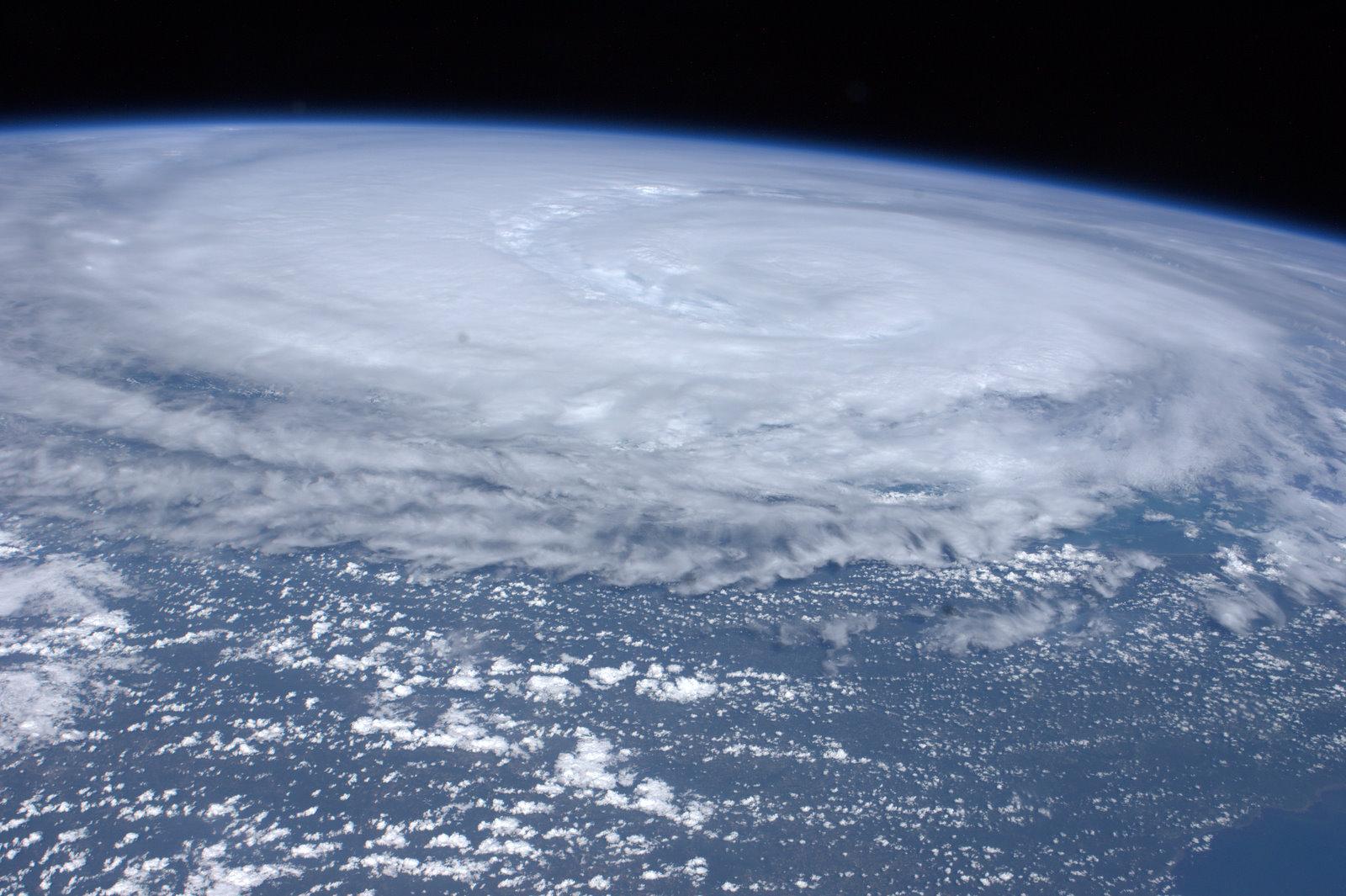
An Expedition 28 crew member aboard the International Space Station captured this image of Hurricane Irene off the east coast of the United States on Friday, August 26, 2011, around 4:30 p.m. EDT (8:30 p.m. GMT).
Hurricane Irene Batters U.S. East Coast - Landfall
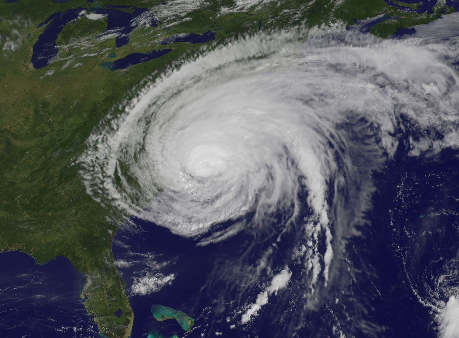
The GOES-13 satellite saw Hurricane Irene on August 27, 2011 at 10:10 a.m. EDT after it made landfall at 8 a.m. in Cape Lookout, North Carolina. Irene's outer bands had already extended into New England.
Hurricane Irene From Space: View of NYC and Boston
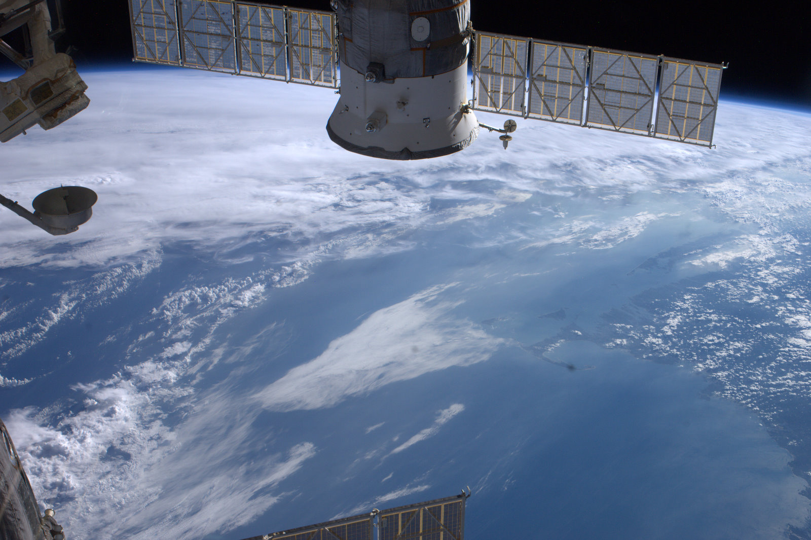
NASA astronaut Ron Garan posted this photo of the New York City, Boston and Cape Cod regions on Aug. 27, 2011 as Hurricane Irene neared. Garan wrote: "#NYC#Boston + #Cape #Fromspace in 'Calm before the Storm' as #Irene visibly looms offshore."
Earth Showing Hurricane Irene August 26, 2011
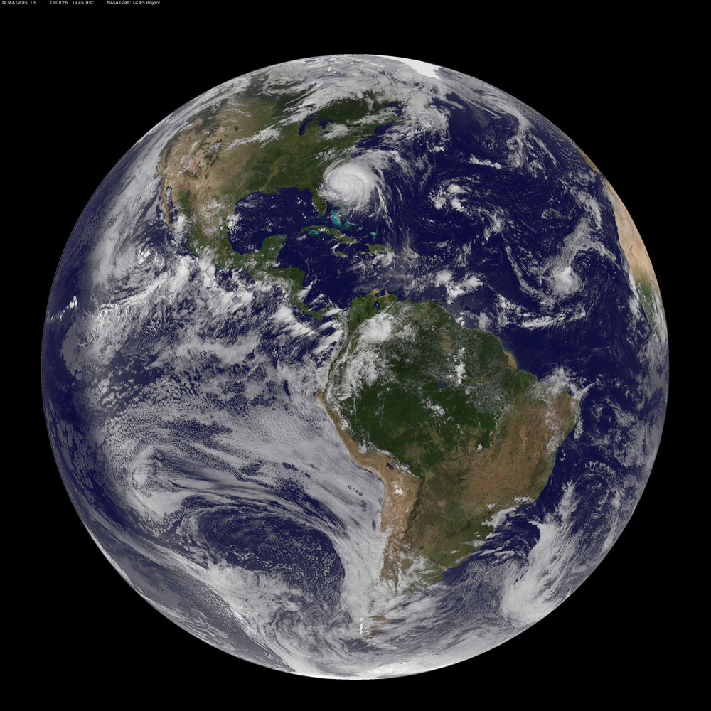
NASA/NOAA GOES-13 satellite image showing the Earth on August 26, 2011 at 14:45 UTC (10:45 a.m. EDT). Hurricane Irene can been seen on the U.S. East Coast. Irene has become a major hurricane, and NASA satellite data shows its diameter is now about 510 miles -- roughly 1/3 the length of the U.S. Atlantic coastline. Hurricane watches are in effect for much of the East Coast.
Hurricane Irene off the Carolinas
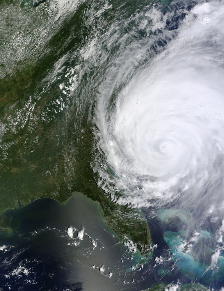
Hurricane Irene off the Carolinas, North America. NASA image captured August 26, 2011, at 16:30 UTC (12:30 p.m EDT).
Hurricane Irene Passing North of Cuba
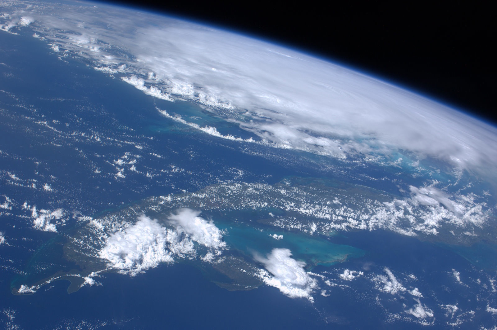
Astronaut Ron Garan continues to send pictures of Hurricane Irene from the International Space Station: "The view #FromSpace of #Hurricane #Irene as it passed north of Cuba @ 7:50pm GMT yesterday 8/25/11."
Another View of Hurricane Irene Passing North of Cuba
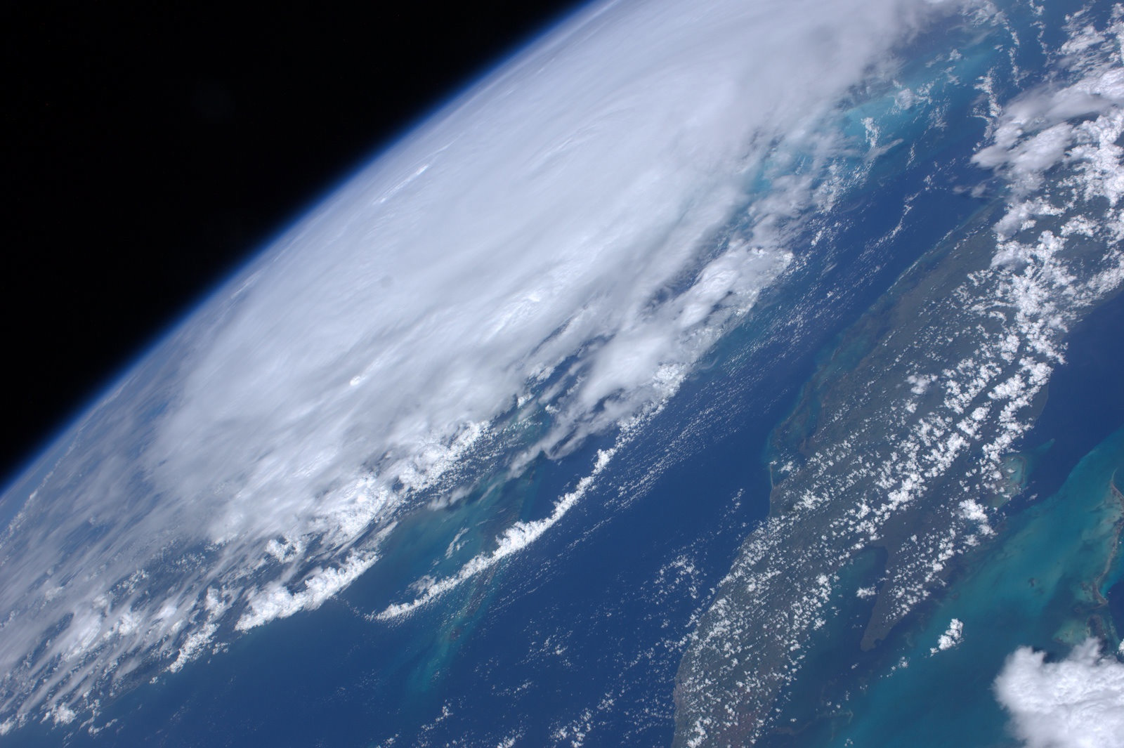
Astronaut Ron Garan tweeted another picture of Hurricane Irene: "Another view #FromSpace of #Hurricane #Irene as it passed north of Cuba @ 7:50pm GMT yesterday 8/25/11."
Get the Space.com Newsletter
Breaking space news, the latest updates on rocket launches, skywatching events and more!
Hurricane Irene Growing Large and Dangerous
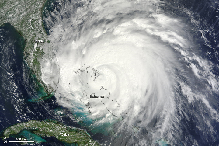
Hurricane Irene is a large and dangerous storm. In this image, taken by the Moderate Resolution Imaging Spectroradiometer (MODIS) on the Terra satellite on August 25, 2011, bands of thunderstorms spiral tightly around a dense center, forming the circular shape of a well-developed hurricane.
Irene Crosses the Earth
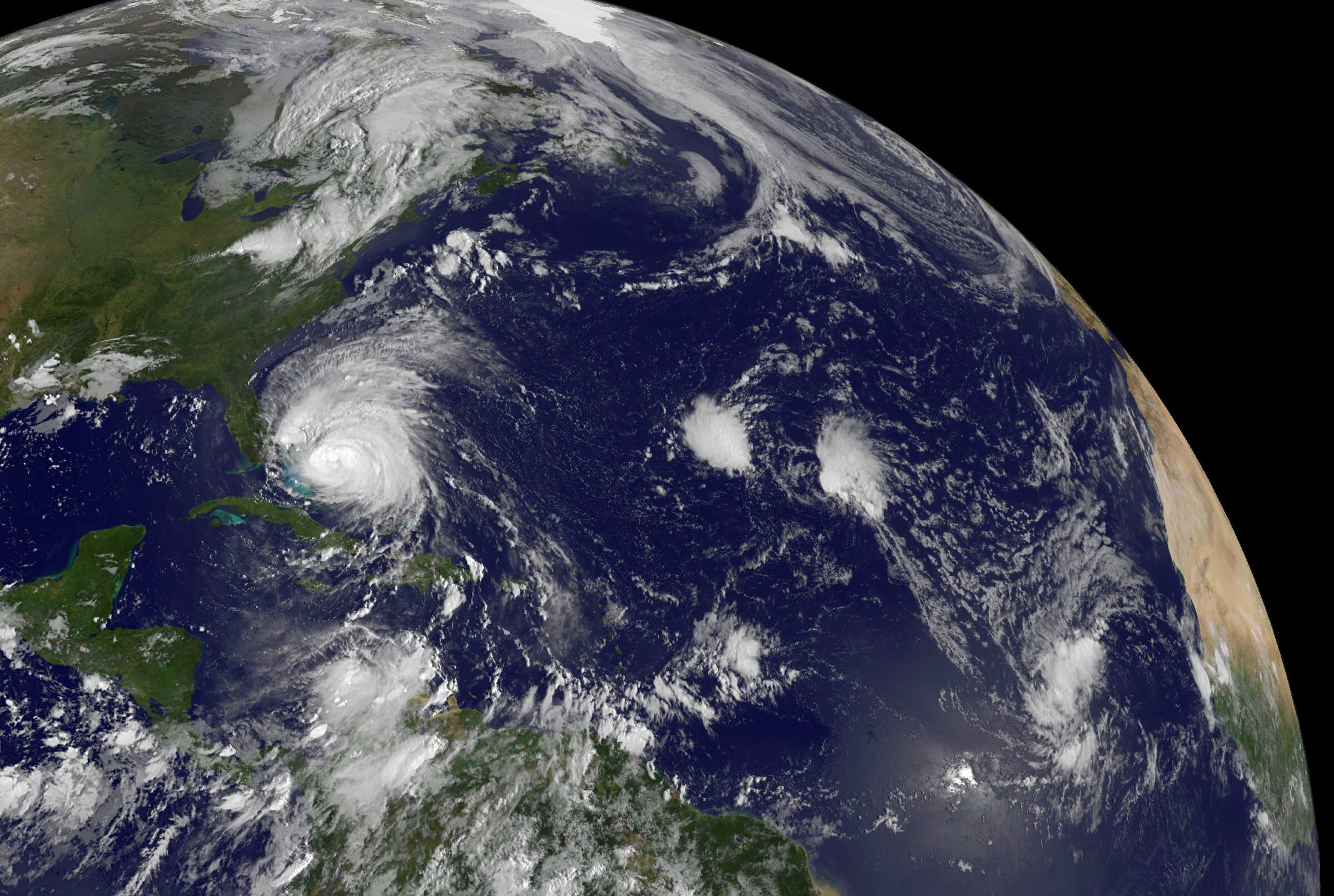
The GOES-13 satellite saw Hurricane Irene moving through the Bahamas on August 25, 2011 at 1402 UTC (10:02 a.m. EDT) and far to the east was newly born Tropical Depression 10. Irene dwarfs Tropical Depression 10, and Irene is about 1/3rd the size of the entire U.S. East coast.
Eye of Irene
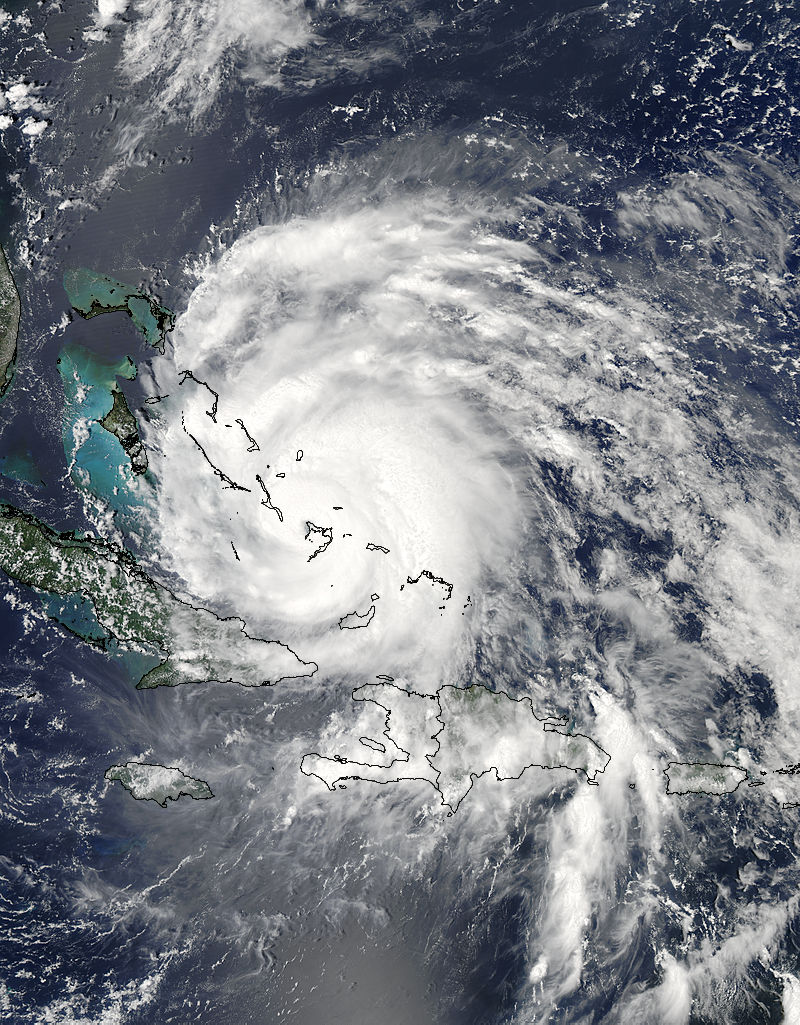
NASA's Terra satellite captured a visible image of Hurricane Irene's eye directly over Crooked Island in the southern Bahamas on August 24, 2011 at 12:15 p.m. EDT.
Irene Over the Bahamas
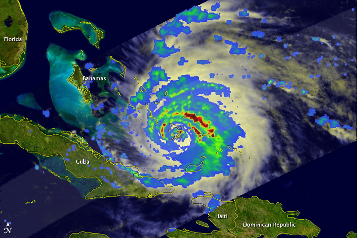
The Tropical Rainfall Measuring Mission (TRMM) satellite took this image of the storm at 11:42 a.m. EDT on August 24, 2011, as Irene was passing over Crooked Island in the southeast Bahamas.
Join our Space Forums to keep talking space on the latest missions, night sky and more! And if you have a news tip, correction or comment, let us know at: community@space.com.

Space.com is the premier source of space exploration, innovation and astronomy news, chronicling (and celebrating) humanity's ongoing expansion across the final frontier. Originally founded in 1999, Space.com is, and always has been, the passion of writers and editors who are space fans and also trained journalists. Our current news team consists of Editor-in-Chief Tariq Malik; Editor Hanneke Weitering, Senior Space Writer Mike Wall; Senior Writer Meghan Bartels; Senior Writer Chelsea Gohd, Senior Writer Tereza Pultarova and Staff Writer Alexander Cox, focusing on e-commerce. Senior Producer Steve Spaleta oversees our space videos, with Diana Whitcroft as our Social Media Editor.
