Australia's Deadly Wildfires in Photos: The View from Space
Satellites are tracking Australia's devastating fires.
Fueled by a lengthy and intensifying drought, an early kickoff to fire season in the Australian states of Queensland and New South Wales began in September 2019 and continued into early 2020. Upwards of 100 wildfires have devastated Australia's southeast coast, killing at least 28 people and more than 1 billion animals.
Satellites from NASA and other agencies are tracking the deadly wildfires from space. Scroll down to photos of Australia's wildfires from space.
Full Coverage:
Jan. 15: Astronauts spot smoke from growing Australian wildfires from space
Jan. 10: Satellites show toll of Australian wildfires on wildlife and human populations
Jan. 7: In Australia, rain falls, but wildfires expected to intensify
Jan. 6: Astronauts spot Australia's deadly wildfires from space station
Get the Space.com Newsletter
Breaking space news, the latest updates on rocket launches, skywatching events and more!
Jan. 3: Satellite images show Australia's devastating wildfires from space
This gallery was updated with new imagery on Jan. 15.
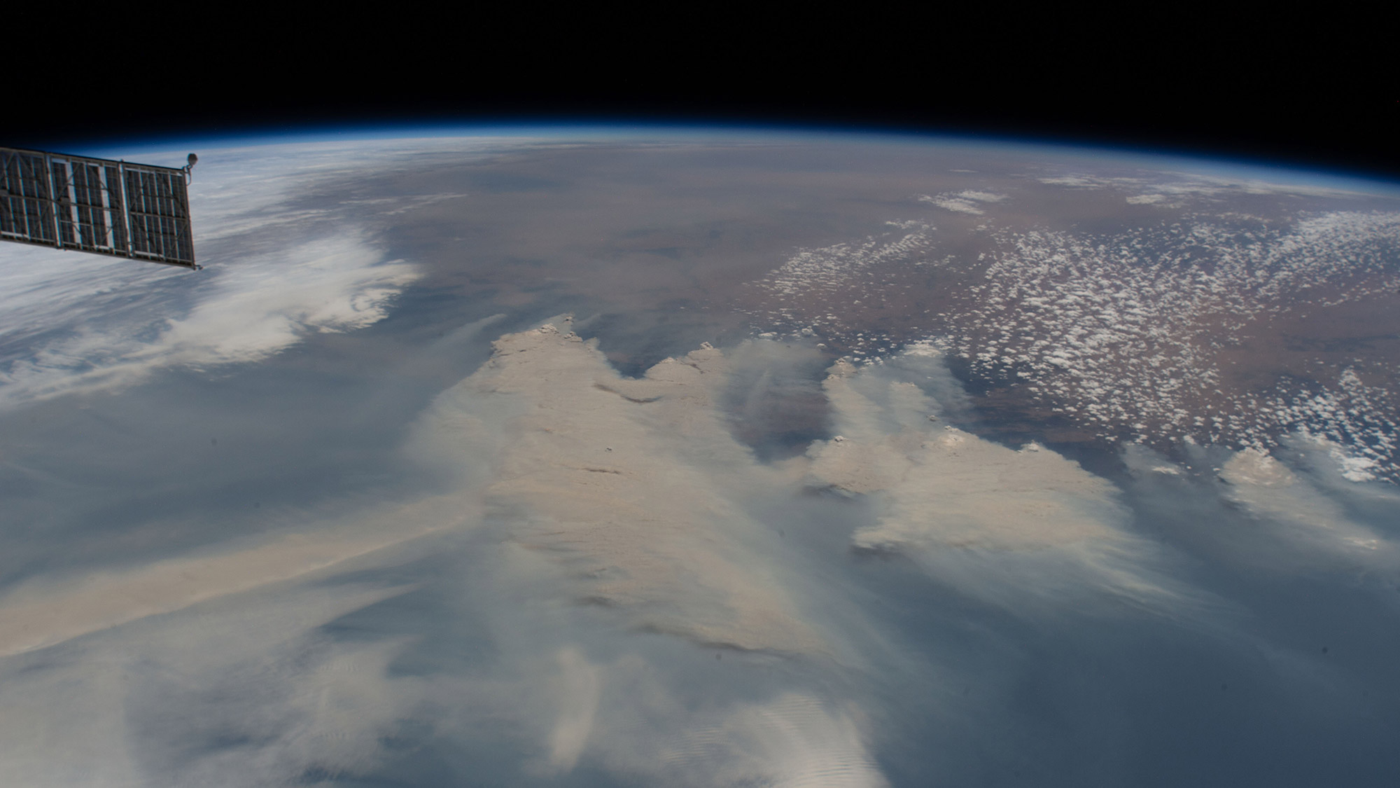
Thick clouds of brown smoke from Australia's bushfires spread across the Tasman Sea in this photo captured by an astronaut at the International Space Station. The photo was taken on Jan. 4, when the station was orbiting 269 miles (433 kilometers) above the Earth.
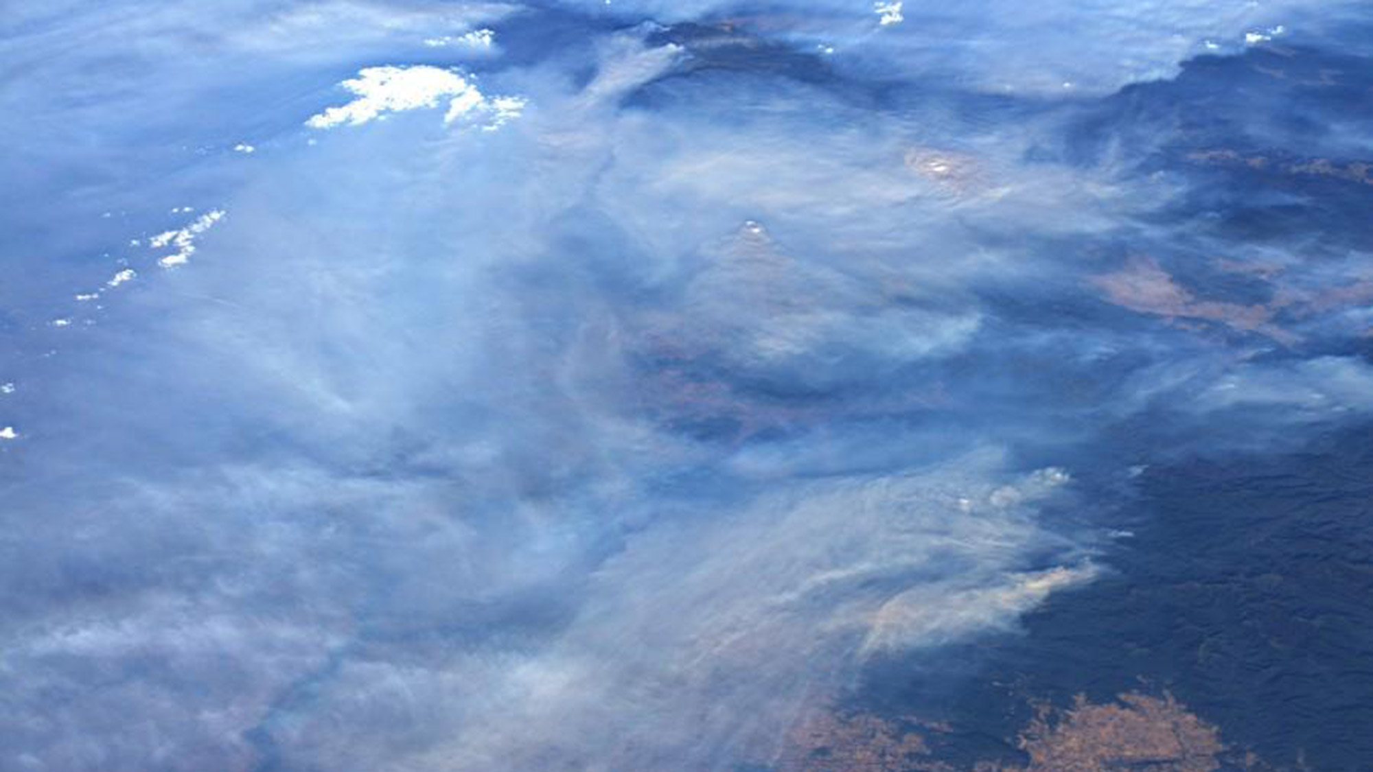
European Space Agency astronaut Luca Parmitano captured this image of the Australian fires on Jan. 12, 2020.
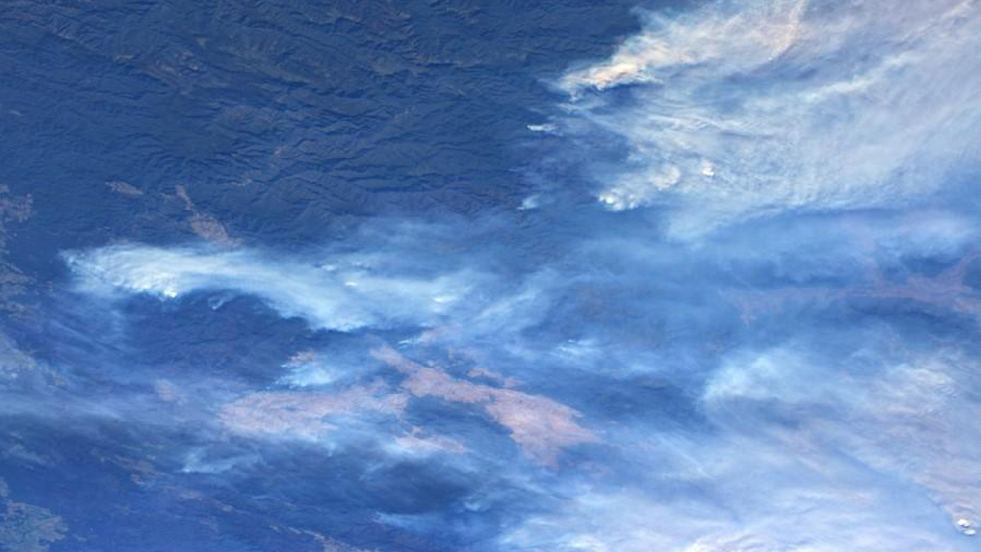
Also taken by European Space Agency astronaut Luca Parmitano on Jan. 12, this image presents several of the wild fires burning across Australia. The astronaut wrote on Twitter, "Australia fires: lives, hopes, dreams in ashes."
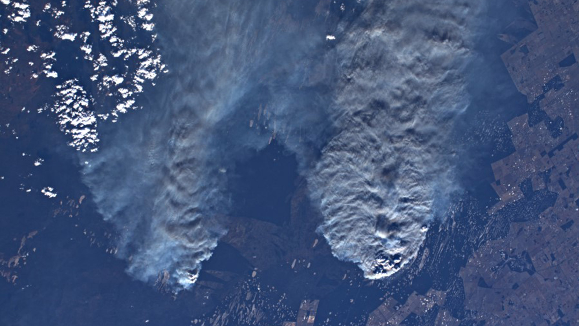
European Space Agency astronaut Luca Parmitano tweeted this Jan. 13 image of the fires burning Down Under.
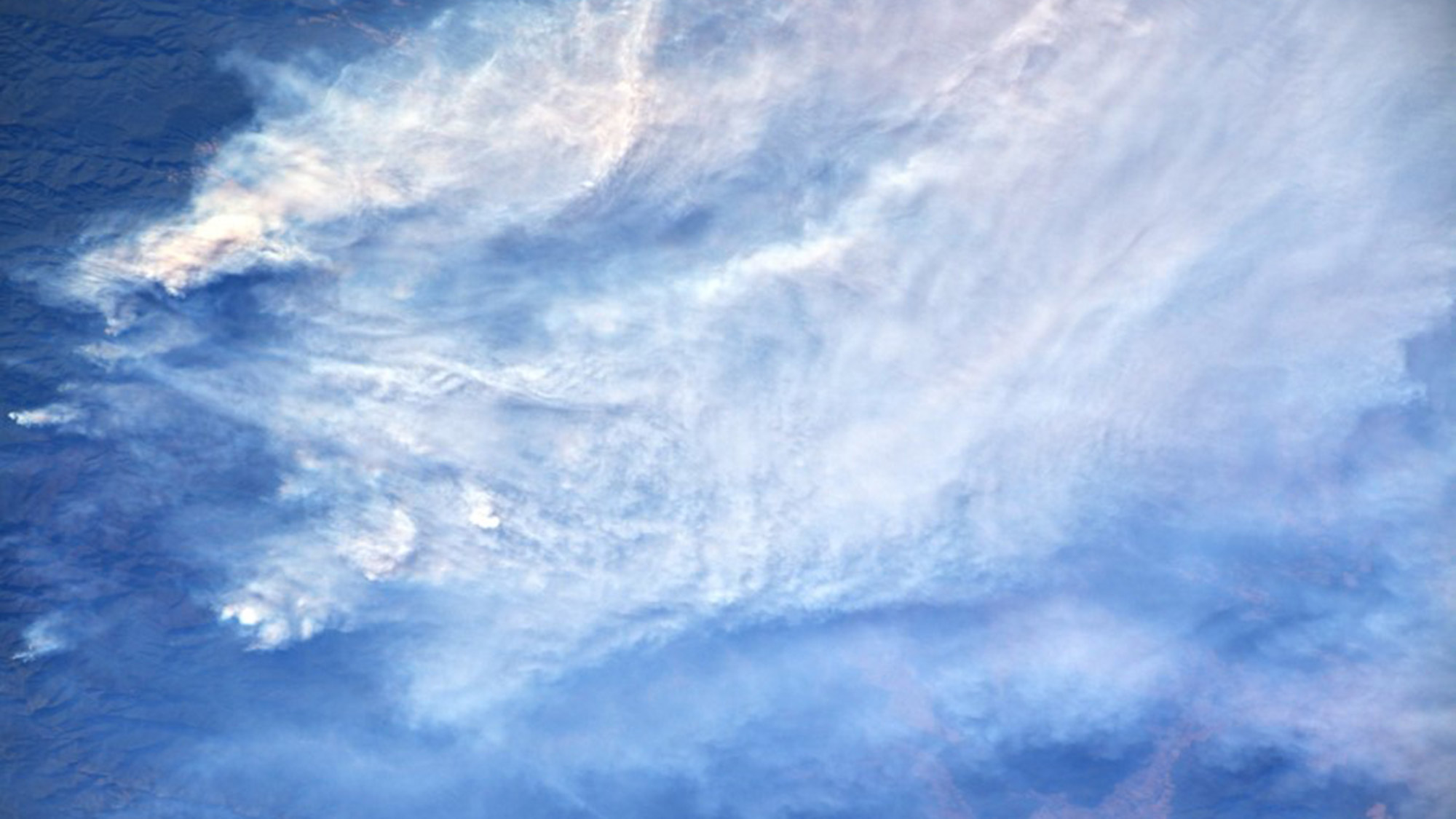
European Space Agency astronaut Luca Parmitano tweeted this image from the International Space Station, on Jan. 13.
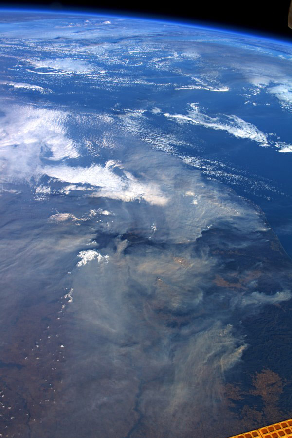
Astronaut Luca Parmitano tweeted this image of the wildfires from the International Space Station, on Jan. 13.
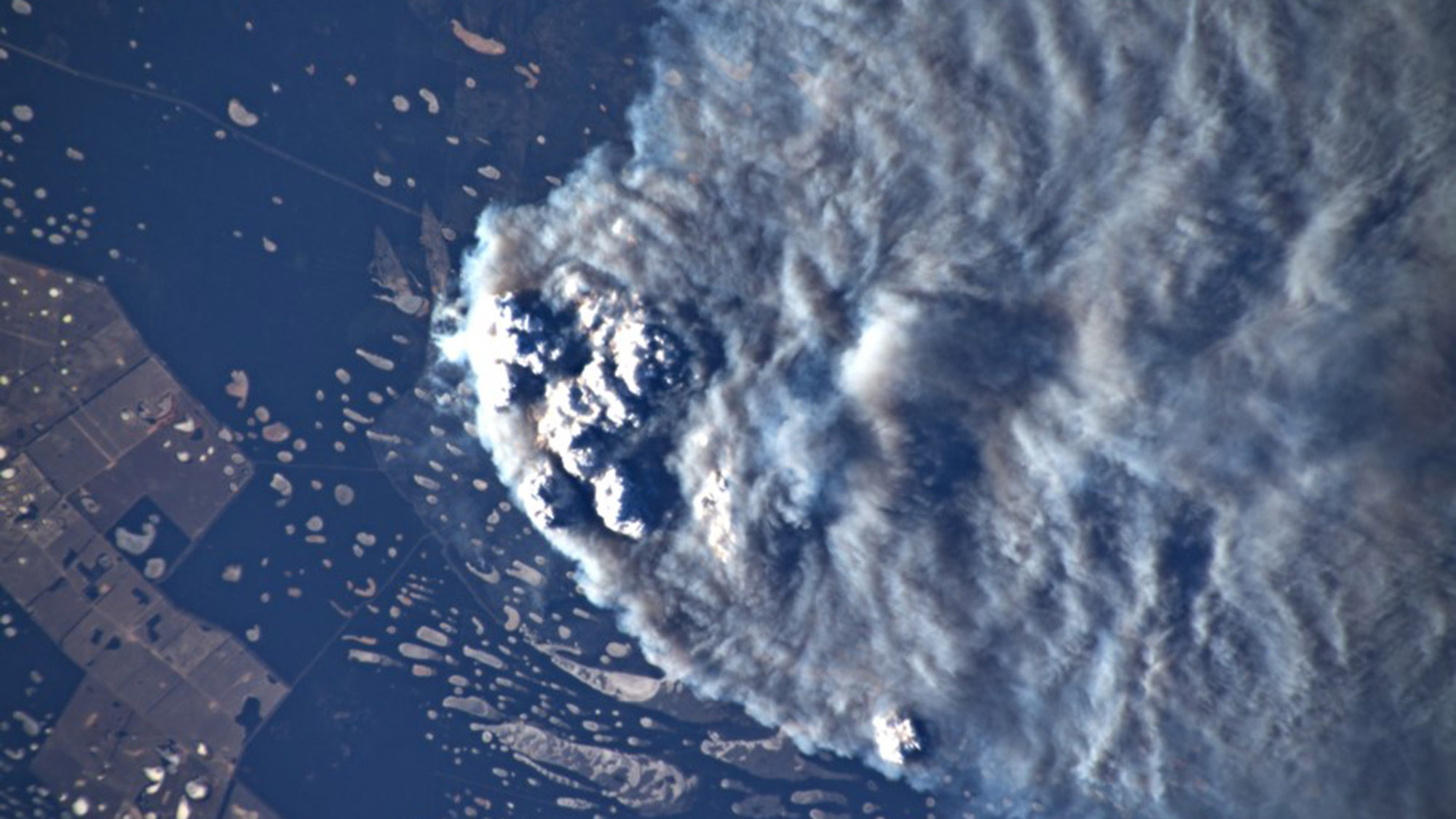
On Jan. 13, 2020, astronaut Luca Parmitano tweeted this image of an immense ash cloud covering Australia.
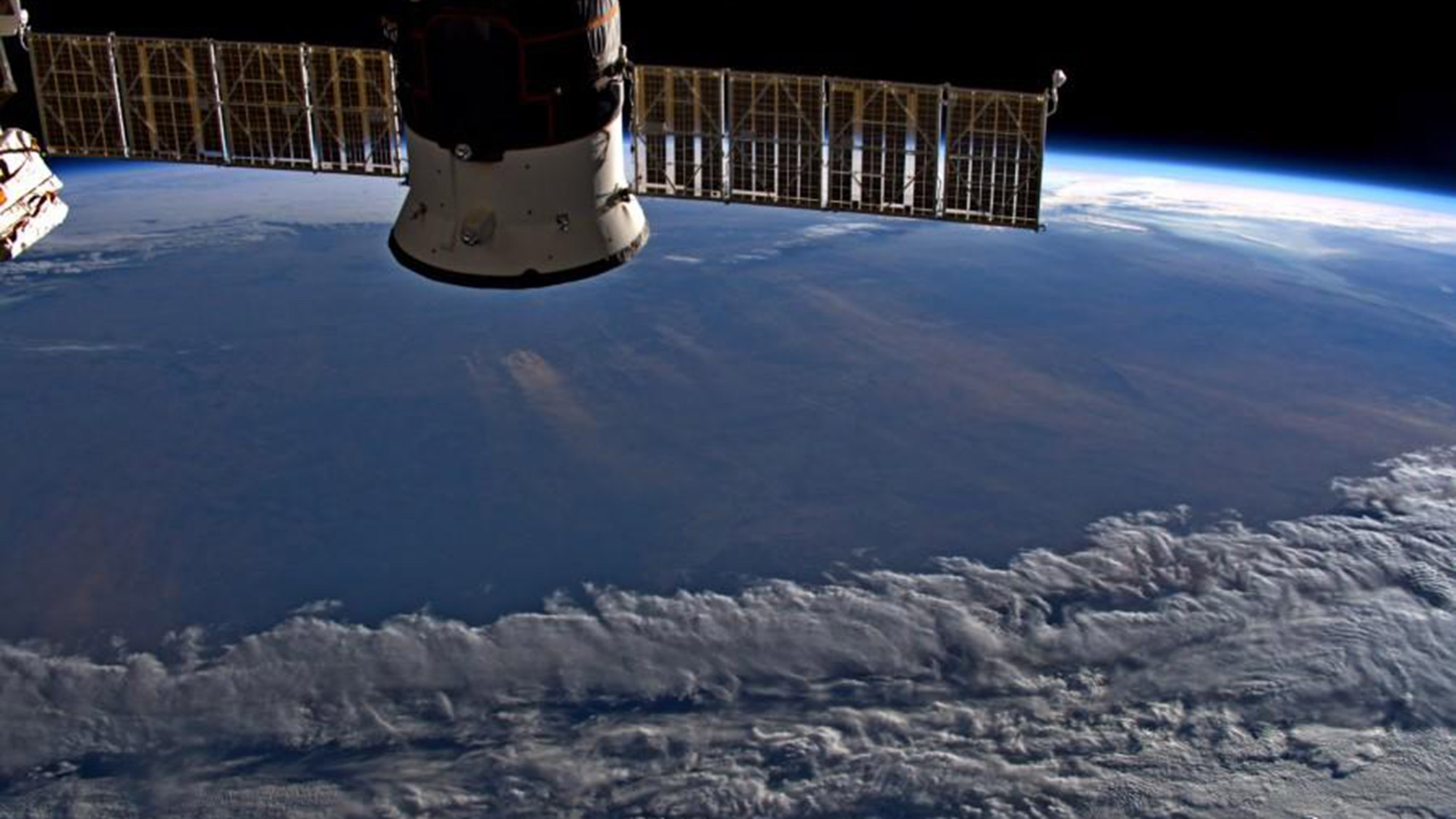
As the International Space Station flew toward sunset on Jan. 13, European Space Agency astronaut Luca Parmitano captured this image of immense ash clouds over Australia.
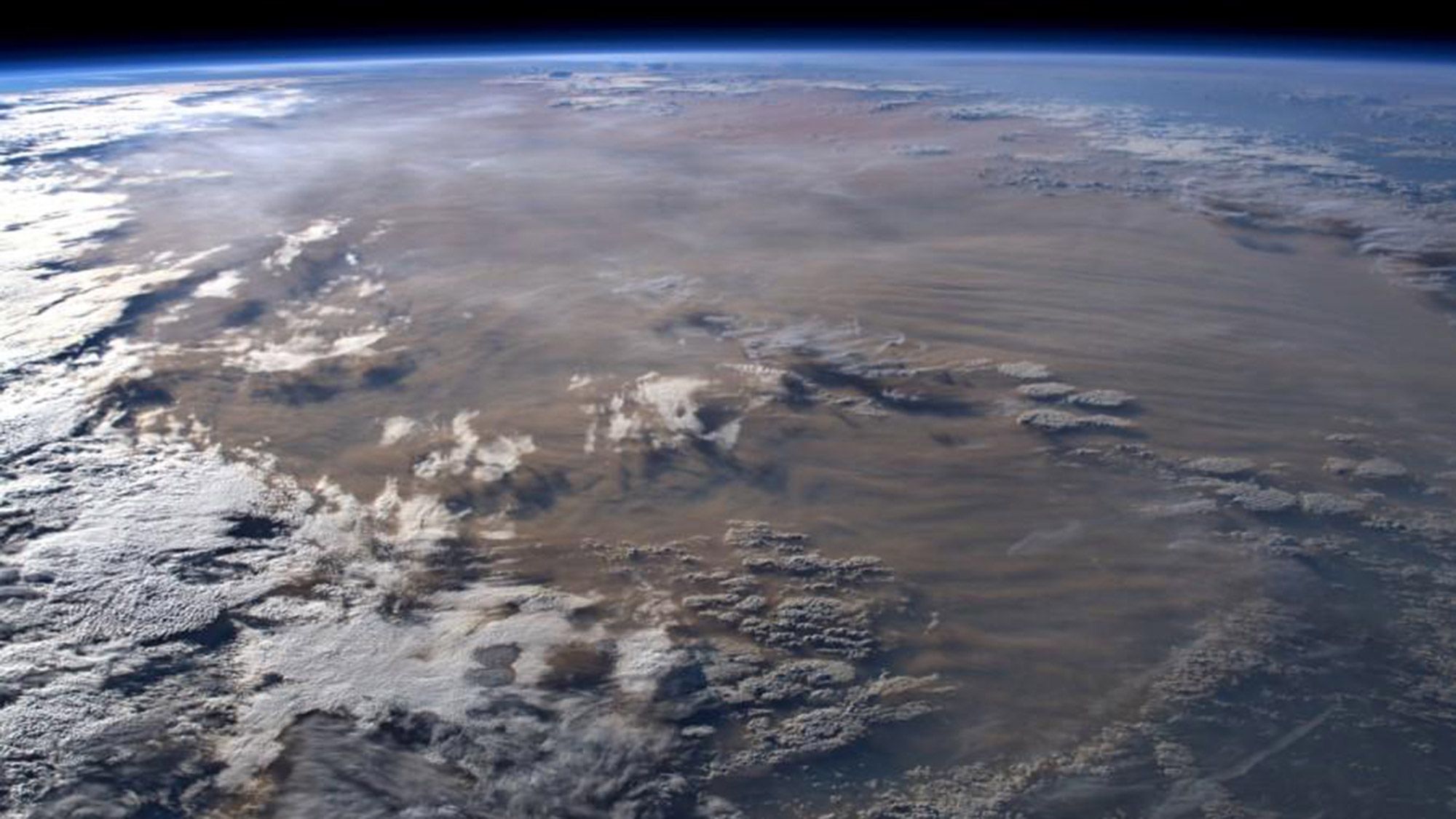
Australian wildfires cover the continent in ash clouds early on Jan. 13.
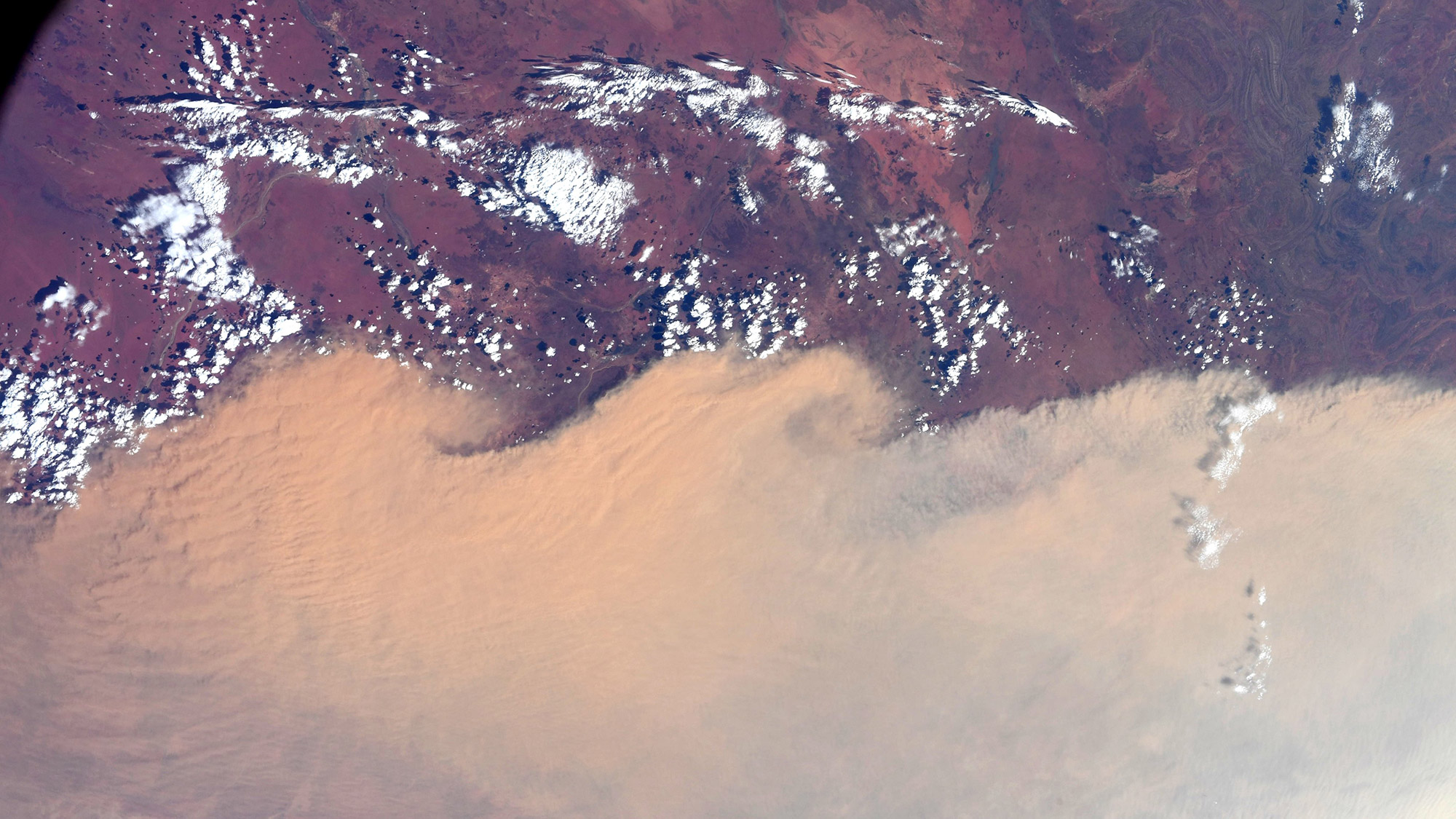
On Jan. 14, NASA astronaut Christina Koch tweeted this image of the Australian continent.
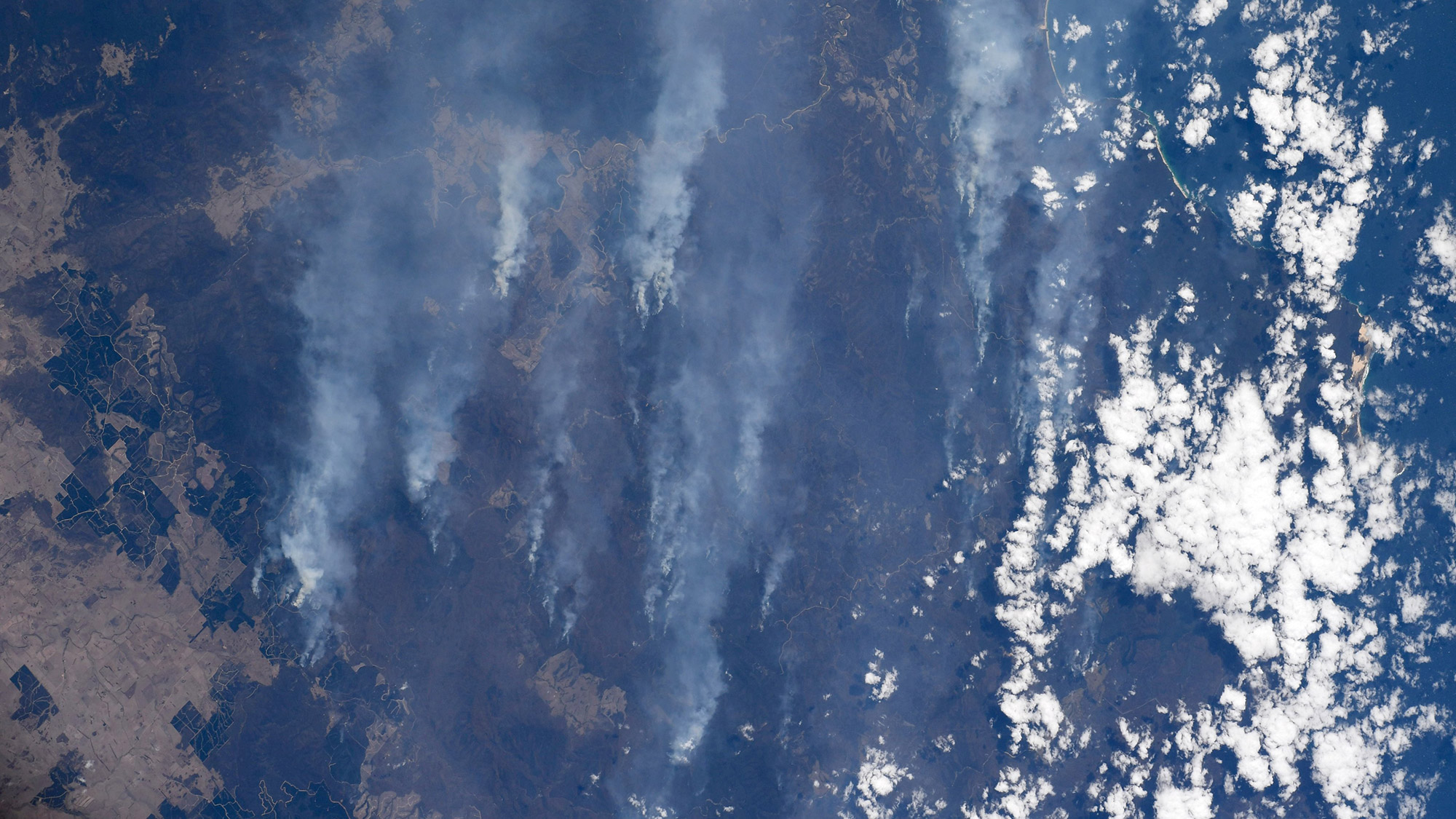
NASA astronaut Christina Koch tweeted this photo on Jan. 14, writing: "Australia. Our hearts and thoughts are with you."
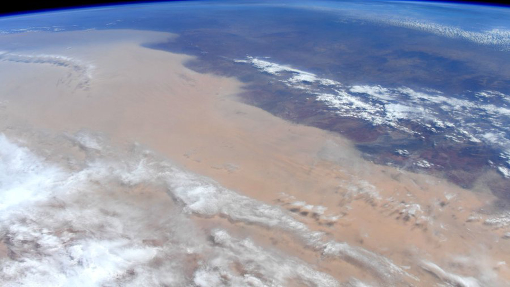
NASA astronaut Christina Koch tweeted out support to Australia on Jan. 14, as the International Space Station orbited above the wildfires.
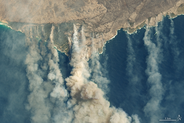
On Jan. 9, 2020, the Operational Land Imager on the NASA-USGS Landsat 8 satellites acquired natural-color images of charred land and thick smoke covering Australia’s Kangaroo Island, where nearly one-third of the land area had burned.
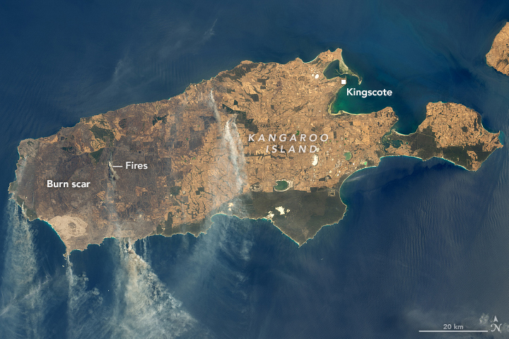
An annotated image of Kangaroo Island shows the burn scars, fires and smoke on Jan. 9, 2020.
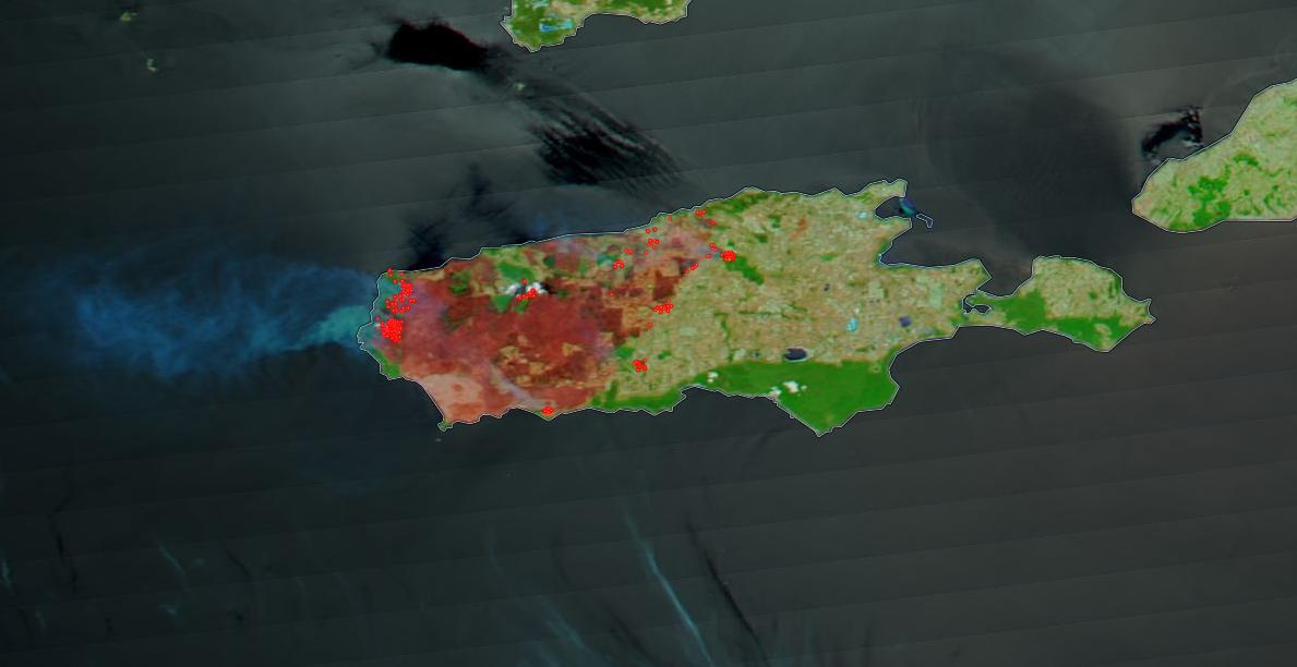
A satellite image taken by NASA's Terra mission in January 2020 shows the extent of wildfire burns on Australia's Kangaroo Island.
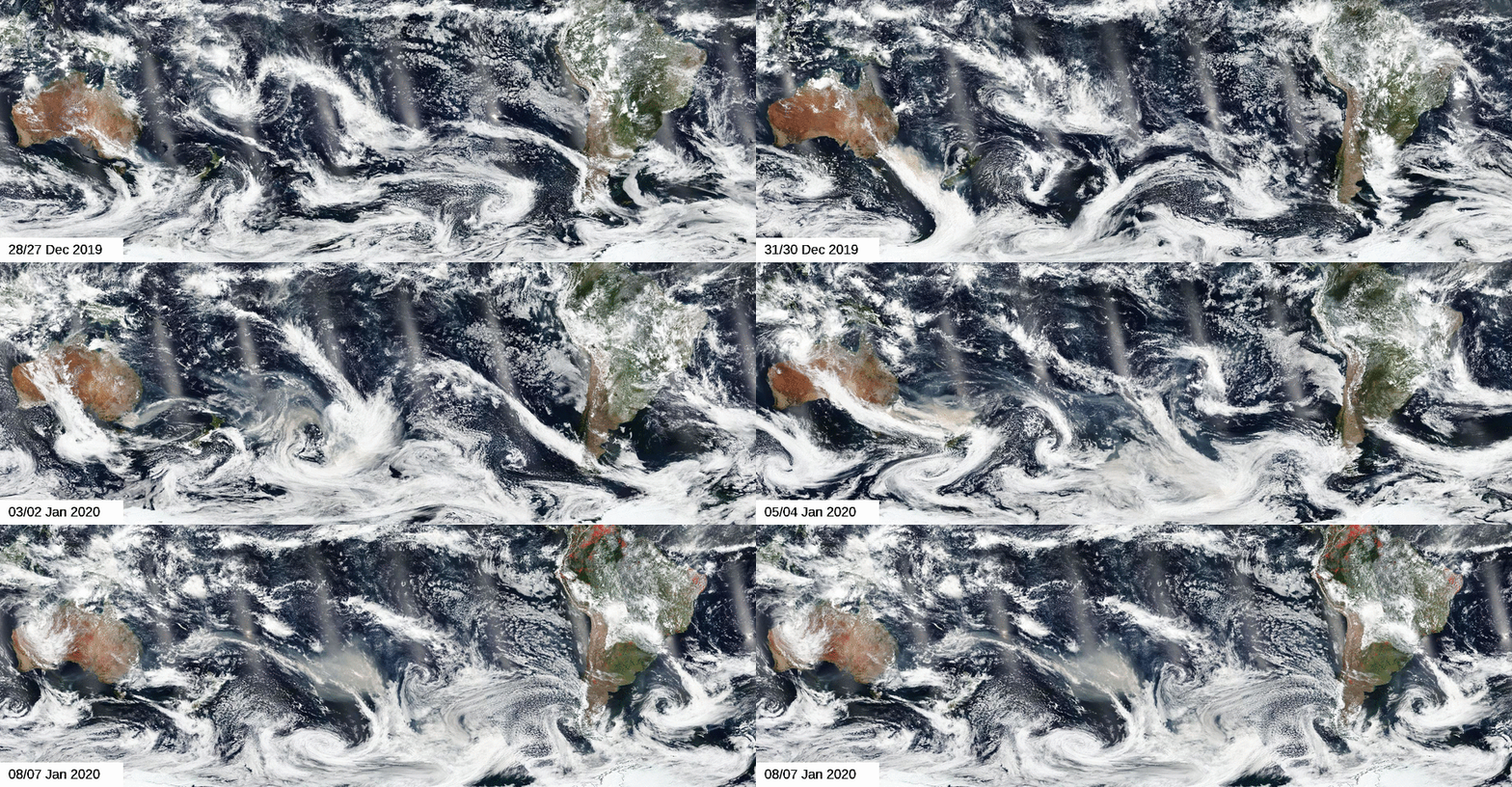
Imagery from the Visible Infrared Imaging Radiometer Suite (VIIRS) on the NASA-NOAA Suomi NPP satellite shows a cloud of brown smoke spreading across the ocean from Australia’s east coast.
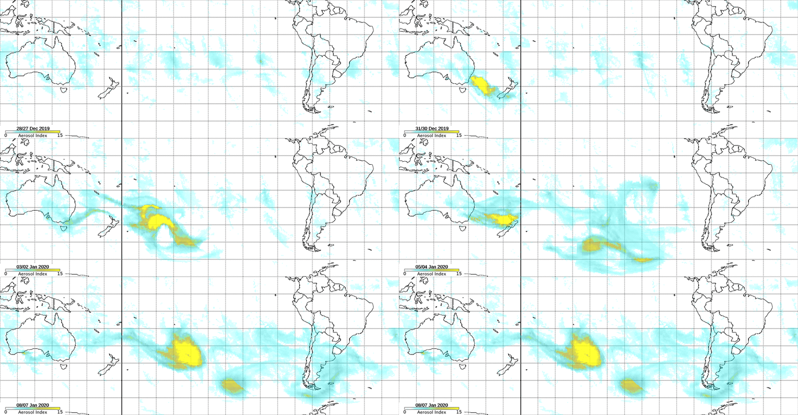
Data from the Ozone Mapping and Profiler Suite on the NASA-NOAA Suomi NPP satellite provides a map of the UV aerosol index, which indicates smoke and dust in the atmosphere.
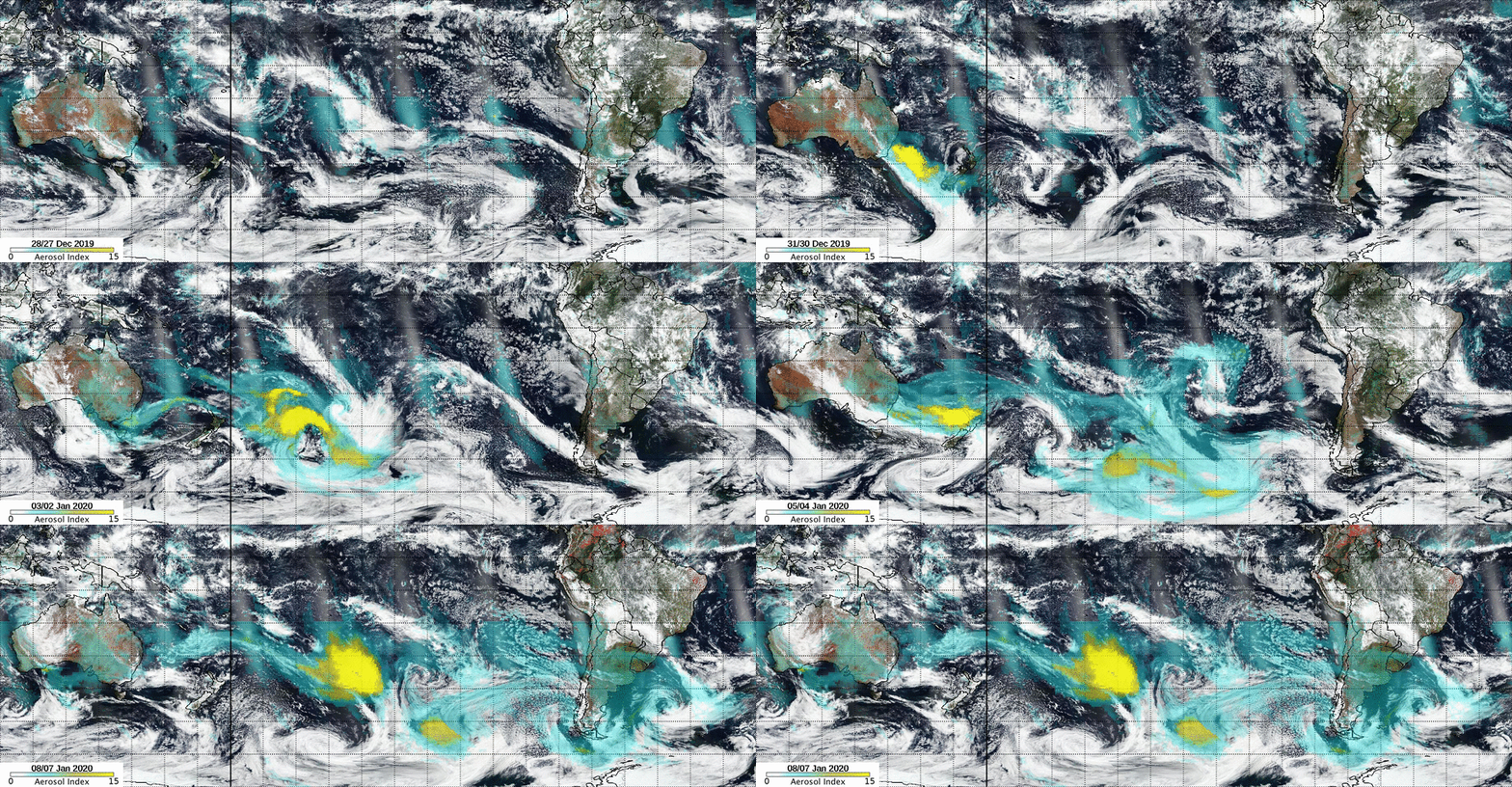
This animation from the Suomi NPP satellite combines “natural-color” imagery with UV aerosol data to illustrate how the wildfires in Australia are spreading aerosols to other parts of the world.
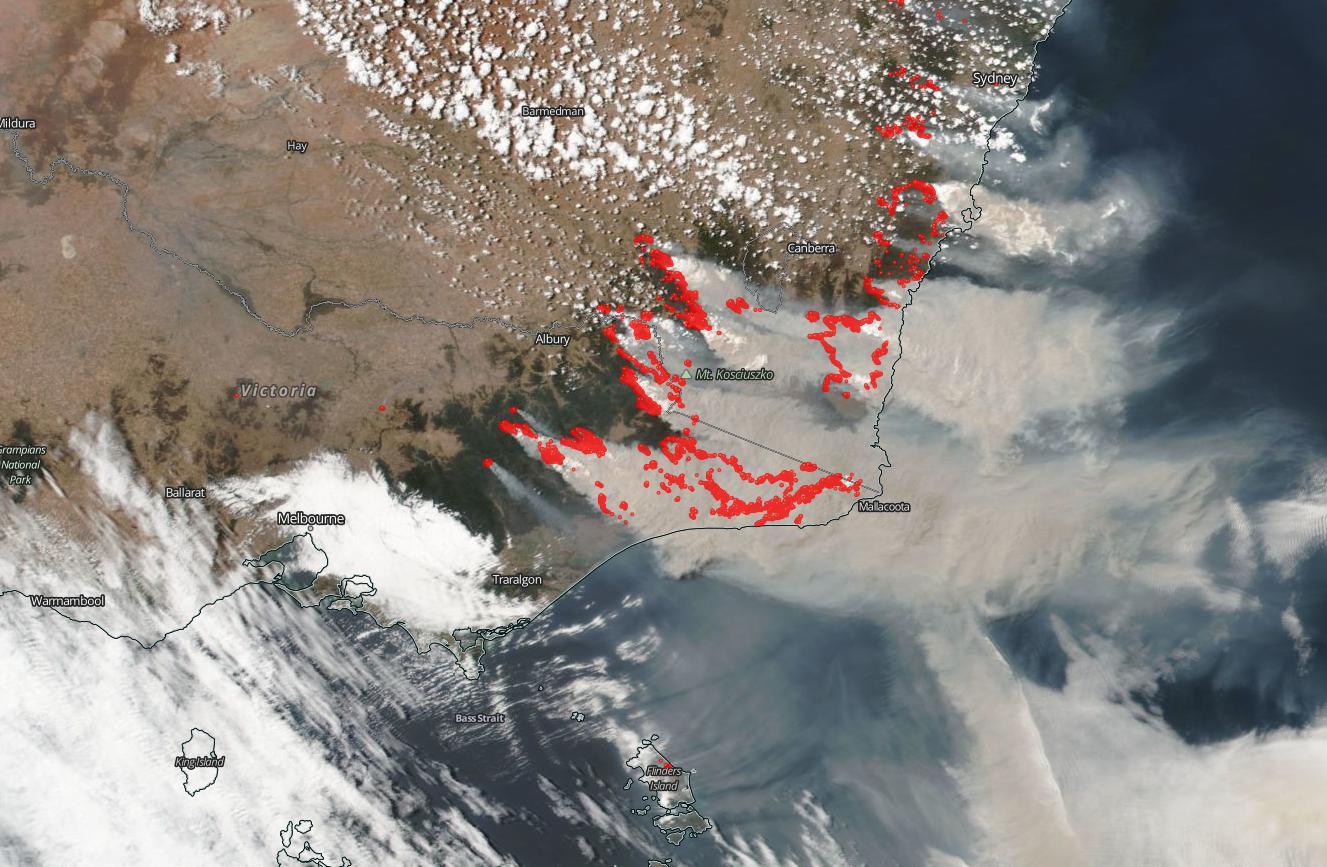
NASA's Aqua satellite, using the MODIS instrument captured smoke plumes coming off the wildfires in southeastern Australia on Jan. 5, 2020.
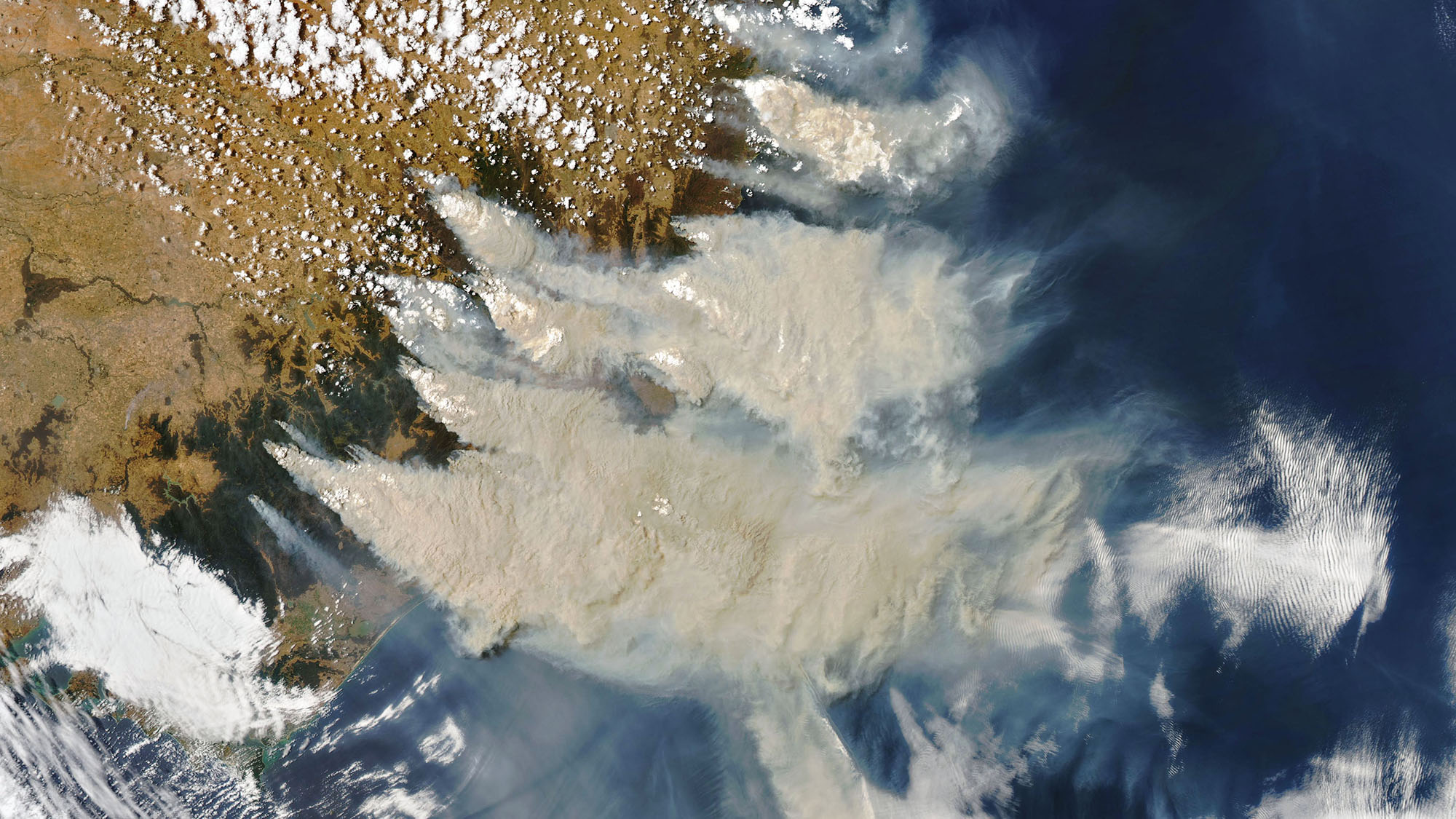
An image from the Moderate Resolution Imaging Spectroradiometer (MODIS) instrument on NASA's Aqua satellite, taken on Jan. 4, 2020, captured smoke plumes blanketing Australia's southeastern coast.
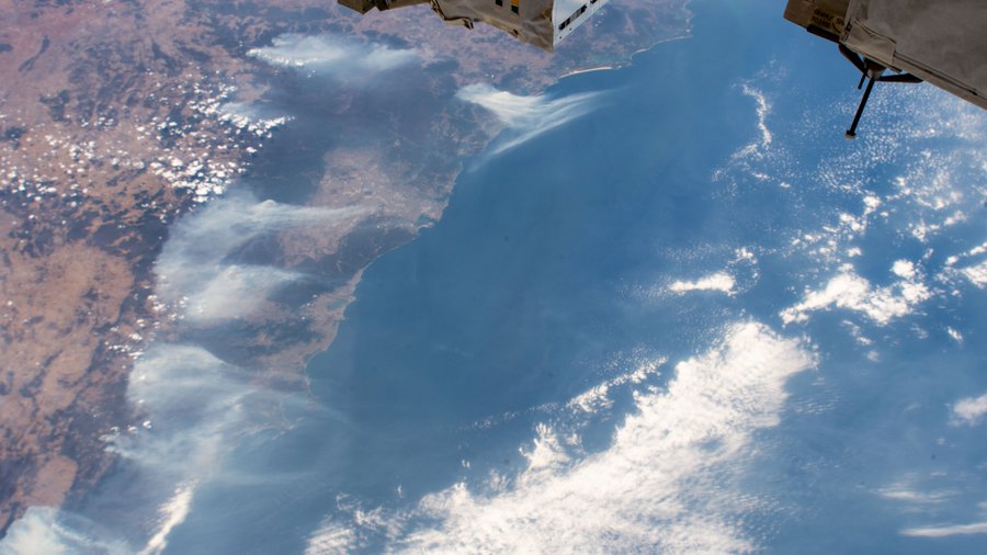
An astronaut on the International Space Station captured this view of smoke from devastating wildfires obscuring the region around Sydney, Australia on Jan. 3, 2020.
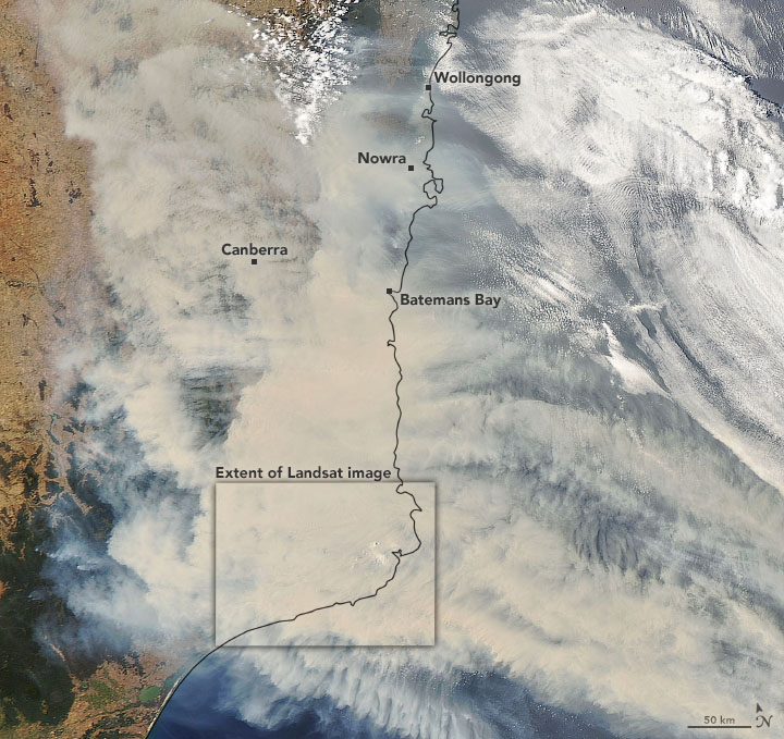
A satellite image of the smoke coming from the Australia wildfires on Jan. 1, 2020.
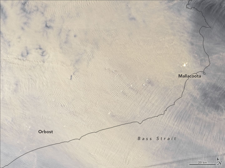
A closeup view of the same satellite image of the smoke coming from the Australia wildfires on Jan. 1, 2020.
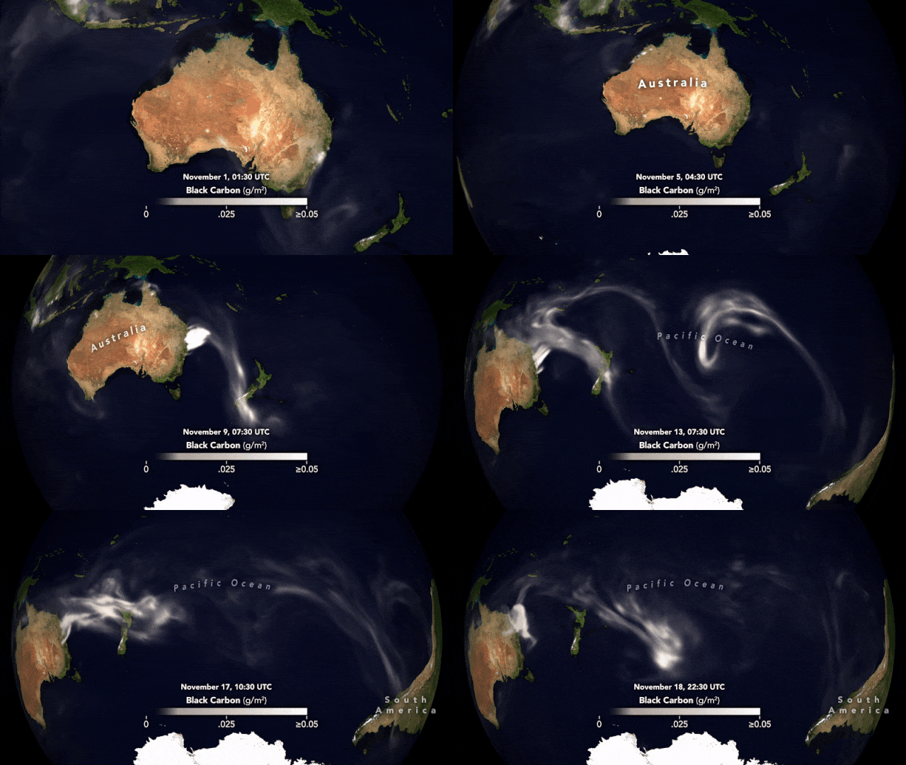
This animation is a model of where the black smoke from the raging Australian wildfires is traveling. It's based off of the GEOS forward processing (GEOS FP) model, which combines information from satellite, aircraft and ground-based observation systems and uses data such as air temperature, moisture levels and wind information to project the plume's behavior.
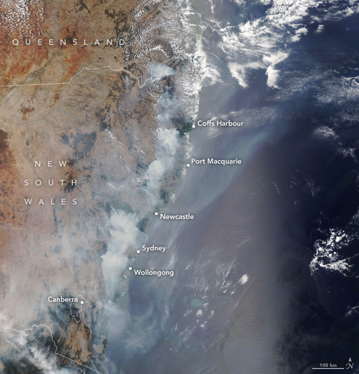
NASA's Aqua satellite used its Moderate Resolution Imaging Spectroradiometer to capture this view of wildfires raging on Australia's eastern coast on Dec. 9, 2019. The wildfires were fueled by unusually hot weather and a potent drought that primed the region in October 2019, according to the space agency.
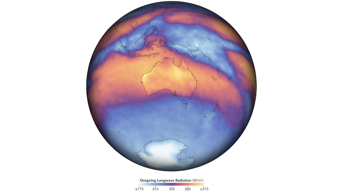
This map depicts measurements of outgoing longwave radiation in November 2019. The data on Australia's heat emission comes from the Clouds and the Earth's Radiant Energy System on board NASA's Terra satellite.
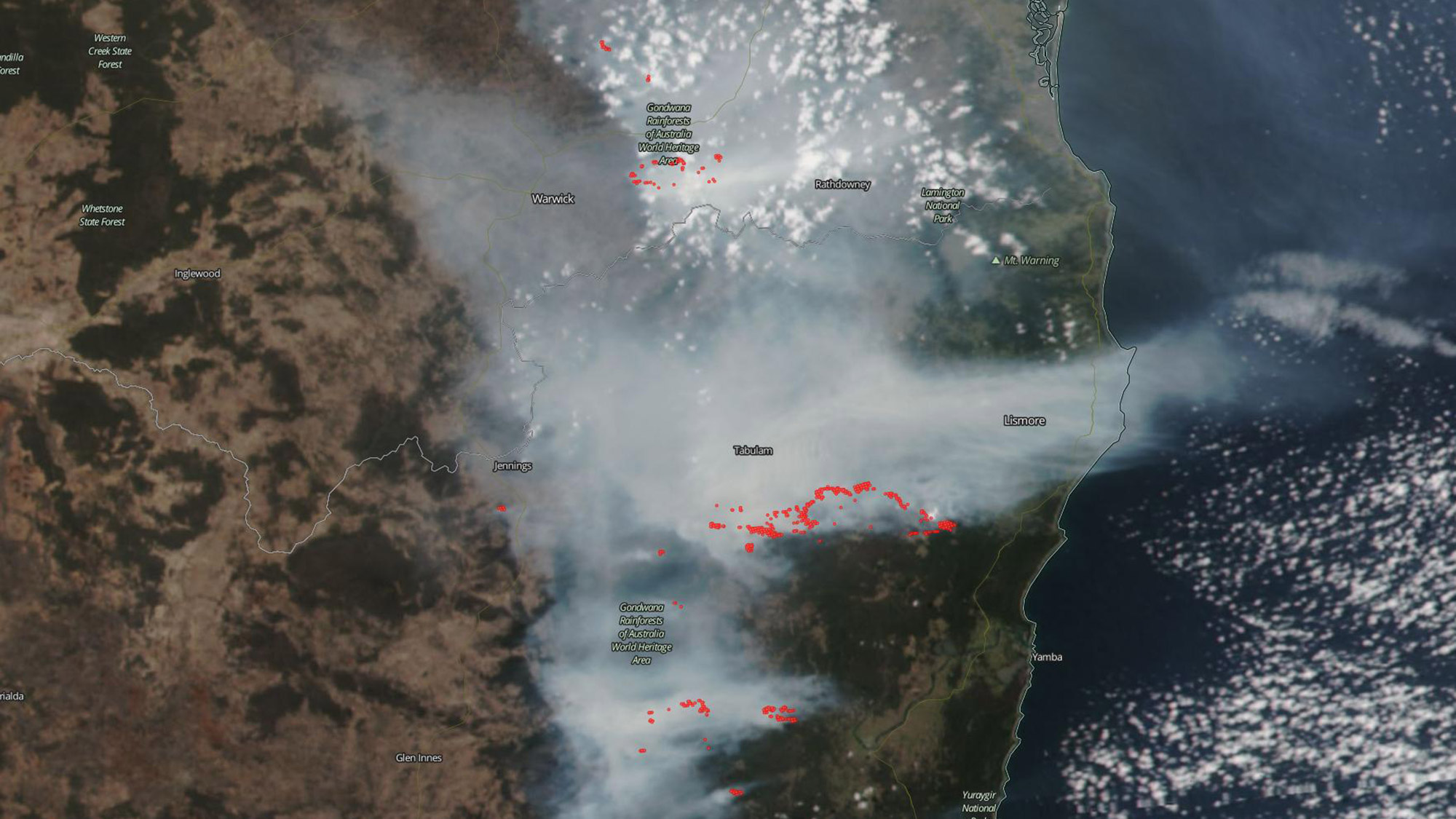
In Australia's Lamington National Park and Gondwana Rainforests fires created large amounts of smoke visible in this Suomi NPP satellite image, captured on Oct. 9, 2019.
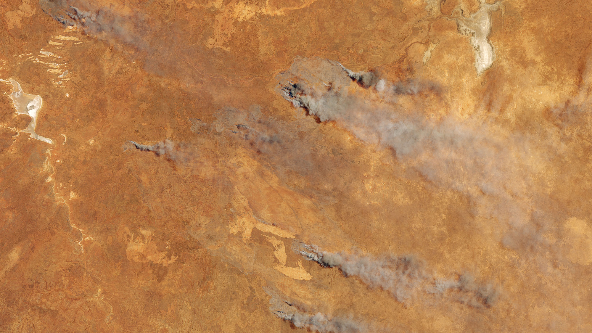
Taken on Nov. 5, 2019, this image shows fire and smoke over southern Western Australia. The image, taken by the Operational Land Imager, exhibits fire in the Goldfields region.
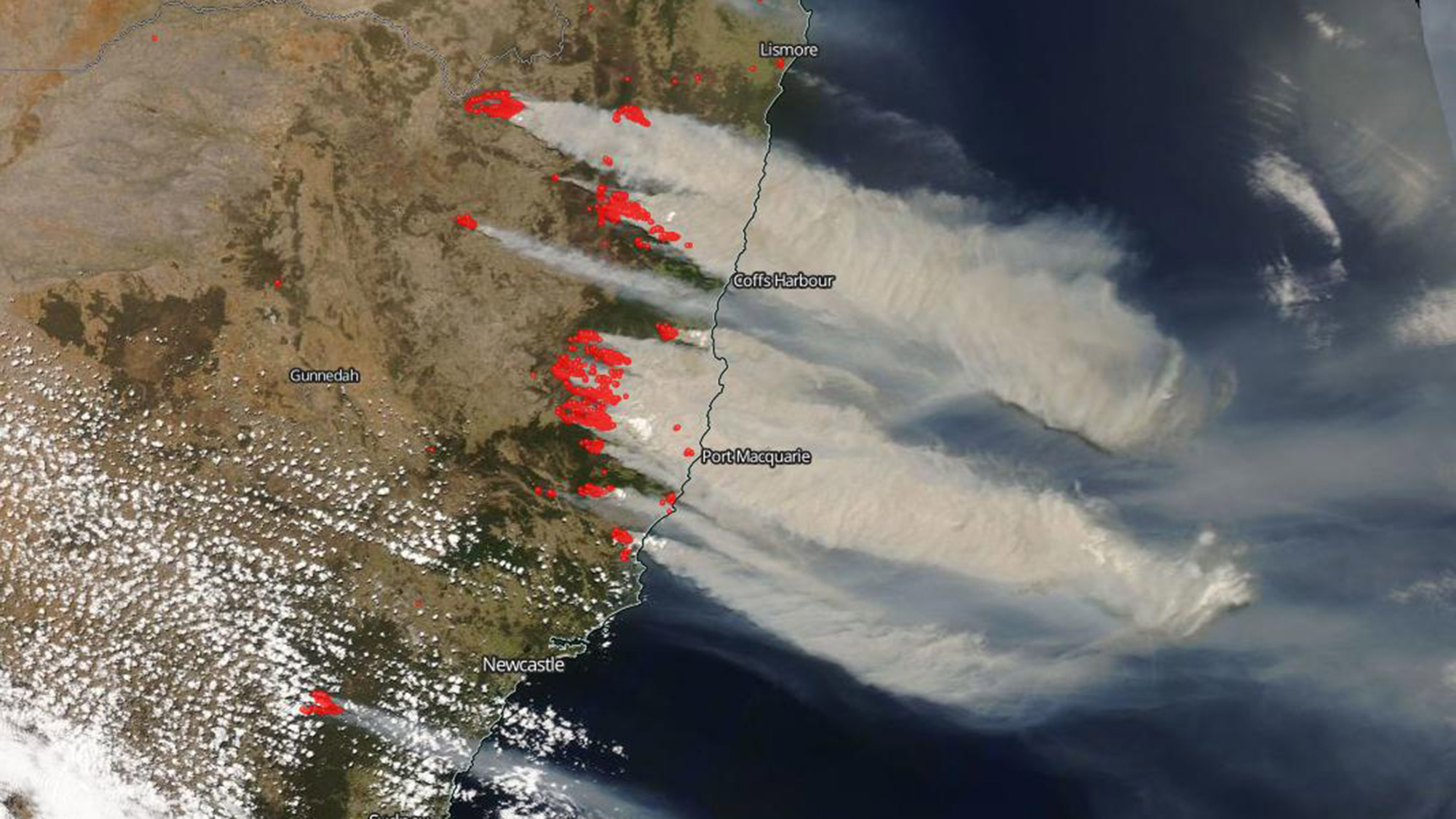
The Visible Infrared Imaging Radiometer Suite on the Suomi NPP satellite captured the recent outbreak of fires in New South Wales in this image from Nov. 8, 2019. Thick smoke is blowing over the Tasman Sea.
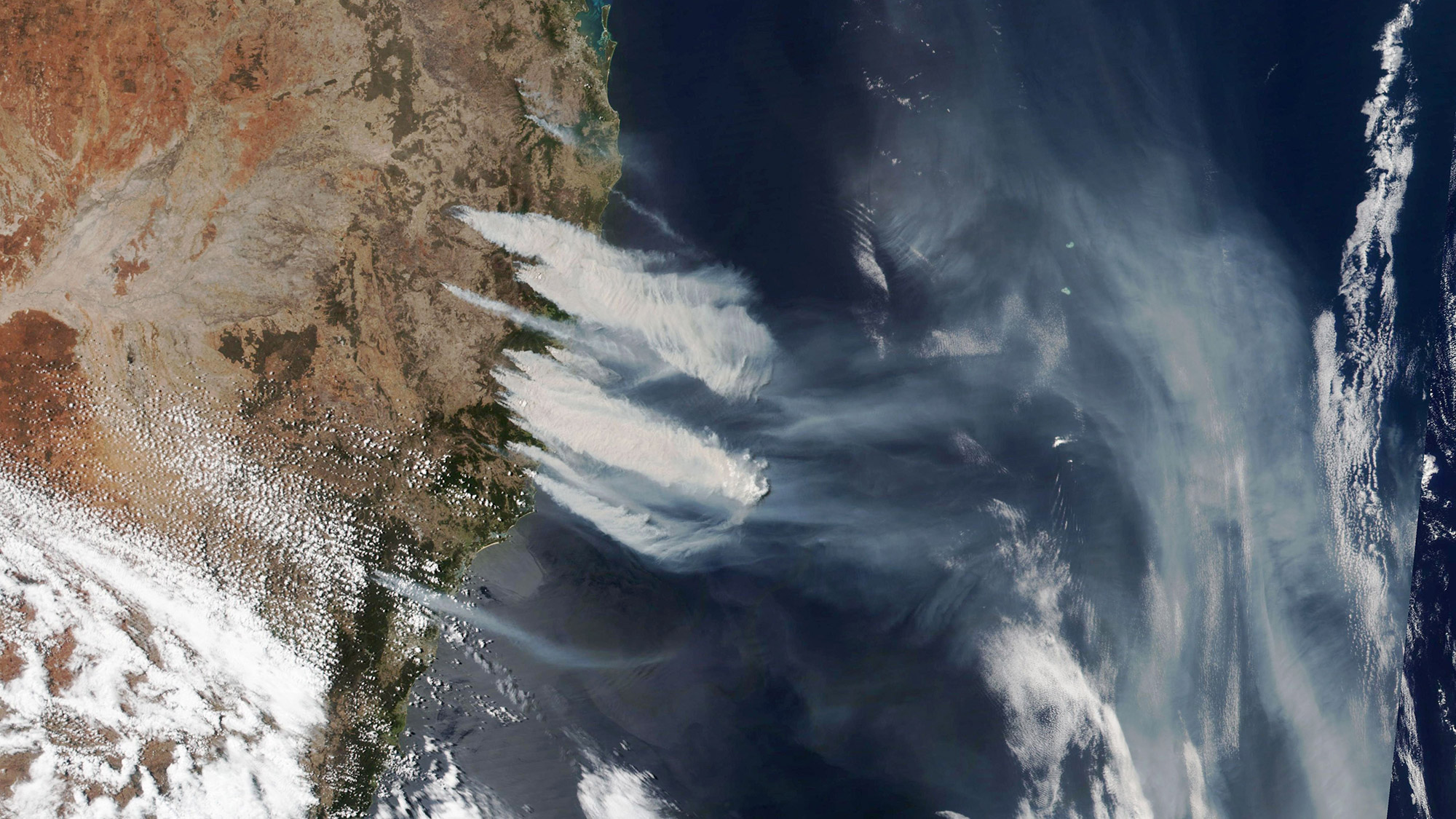
More than 100 bushfires burned on the east coast of Australia, stretching from the Blue Mountains to the border of Queensland, which has over 50 of its own blazes. The hot, dry and windy weather has precipitated an early and grisly start to this year's fire season.
Join our Space Forums to keep talking space on the latest missions, night sky and more! And if you have a news tip, correction or comment, let us know at: community@space.com.

Christine Lunsford joined the Space.com team in 2010 as a freelance producer and later became a contributing writer, covering astrophotography images, astronomy photos and amazing space galleries and more. During her more than 10 years with Space.com, oversaw the site's monthly skywatching updates and produced overnight features and stories on the latest space discoveries. She enjoys learning about subjects of all kinds.
