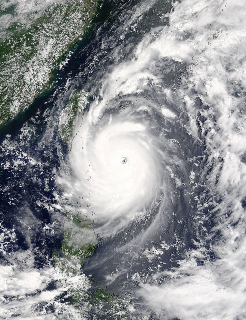
New satellite photos show the size and power of Super Typhoon Nepartak, which is churning toward landfall in Taiwan later today (July 8).
Nepartak's central eye and swirling bands of surrounding thunderstorms are clearly visible in a photo taken by NASA's Terra satellite late Wednesday night (July 6).
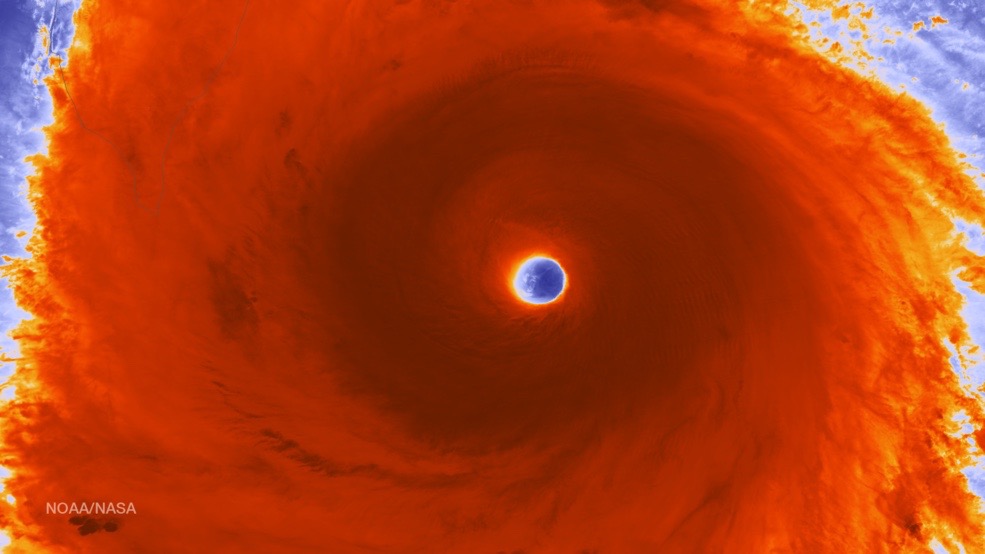
And the extent and structure of these thunderstorms are highlighted in another image, this one a close-up photo captured early this morning (July 7) in infrared and visible light by the Suomi NPP spacecraft, which is jointly operated by NASA, the U.S. National Oceanographic and Atmospheric Administration (NOAA) and the U.S. Department of Defense.
As of this morning, Super Typhoon Nepartak had maximum sustained wind speeds of 161 mph (140 knots), with gusts up to 196 mph (170 knots), according to an update from the U.S. military's Joint Typhoon Warning Center (JWTC).
The storm is expected to hit Taiwan tonight around 8 p.m. EDT (0000 GMT on July 8), move southeast-to-northwest across the island, and then slam into the Chinese mainland about 8 p.m. EDT on Friday (July 8; 0000 GMT on July 9), NASA officials said.

Nepartak should run out of steam shortly after making this second landfall, experts have said.
To learn more about Nepartak's approach to Taiwan, and the possible impacts to the island and its people, visit Taiwan's Central Weather Bureau site here: http://www.cwb.gov.tw/V7e/
Get the Space.com Newsletter
Breaking space news, the latest updates on rocket launches, skywatching events and more!
Powerful storms such as Nepartak are called hurricanes in the Atlantic and Northeast Pacific regions, typhoons in the North Pacific and cyclones throughout the South Pacific and the Indian Ocean.
The JWTC classifies typhoons with maximum sustained wind speeds of 150 mph (130 knots) or greater as "super typhoons" — the equivalent of a Category 4 or Category 5 hurricane.
Follow Mike Wall on Twitter @michaeldwall and Google+. Follow us @Spacedotcom, Facebook or Google+. Originally published on Space.com.
Join our Space Forums to keep talking space on the latest missions, night sky and more! And if you have a news tip, correction or comment, let us know at: community@space.com.

Michael Wall is a Senior Space Writer with Space.com and joined the team in 2010. He primarily covers exoplanets, spaceflight and military space, but has been known to dabble in the space art beat. His book about the search for alien life, "Out There," was published on Nov. 13, 2018. Before becoming a science writer, Michael worked as a herpetologist and wildlife biologist. He has a Ph.D. in evolutionary biology from the University of Sydney, Australia, a bachelor's degree from the University of Arizona, and a graduate certificate in science writing from the University of California, Santa Cruz. To find out what his latest project is, you can follow Michael on Twitter.
