NASA Is Tracking Monster Hurricanes Irma, Jose and Katia from Space
Hurricane Irma appears strikingly large on its course toward Florida in a new video from NASA and the National Oceanic and Atmospheric Administration (NOAA) as the agencies keep tabs on the powerful storm. Meanwhile, Hurricane Jose has been upgraded to a Category 4 hurricane, and Hurricane Katia continues to strengthen as the three storms travel westward.
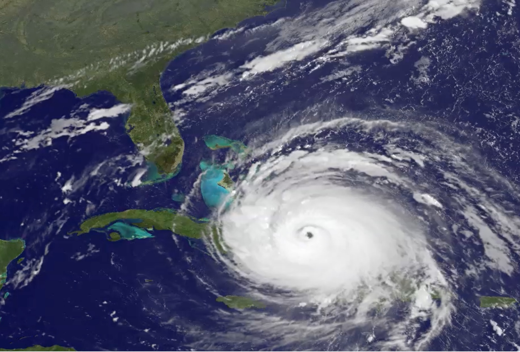
Irma is traveling west-northwest at close to 16 mph (26 km/h) and is set to turn toward the northwest late Saturday, Denise Chow reported on Space.com's sister site Live Science. It is currently passing through the southeastern Bahamas, and by Sunday morning, it should be making its way toward southern Florida. [See Hurricane Irma in Motion in These NASA and NOAA GIFs]
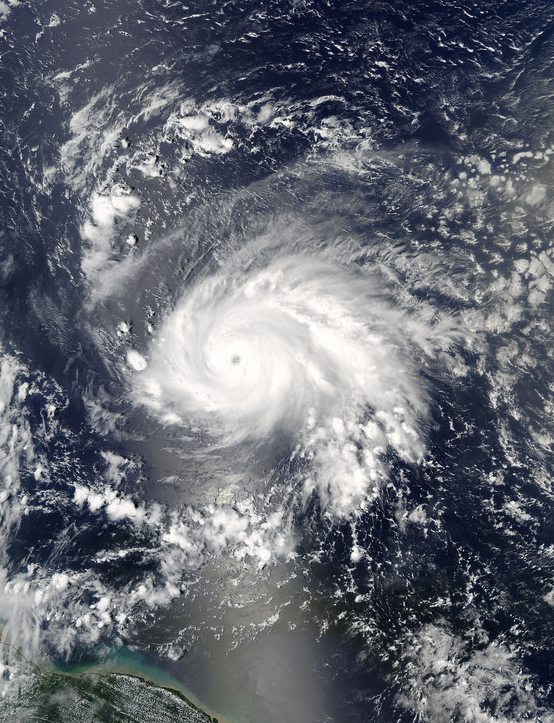
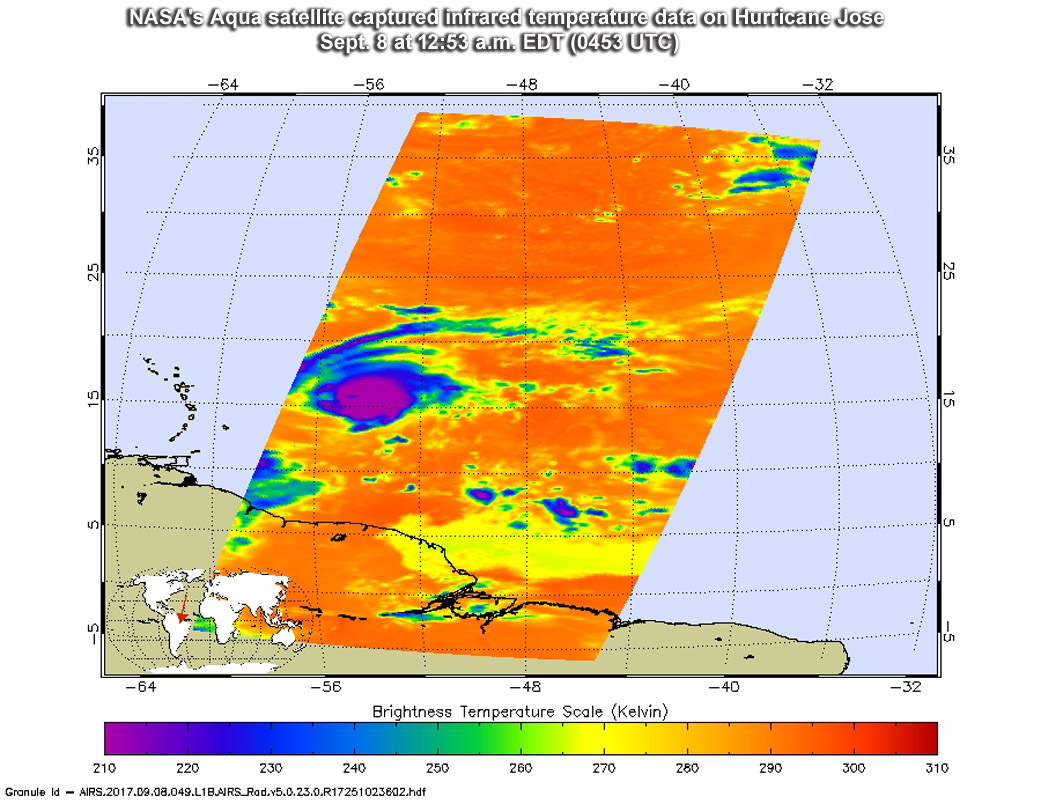
NASA's Aqua satellite caught a view of Hurricane Jose as it strengthened into a powerful Category 4 hurricane. The satellite analyzed the storm in infrared light, NASA officials said in a statement today (Sept. 8), and detected powerful storms near its center. The cloud tops were reaching temperatures as low as minus 63 degrees Fahrenheit (minus 53 degrees Celsius) around the center of circulation, which NASA officials say can generate heavy rainfall.
Jose is heading west-northwest at about 18 mph (29 km/h) and is expected to continue in that direction more slowly over the next few days, NASA officials said.
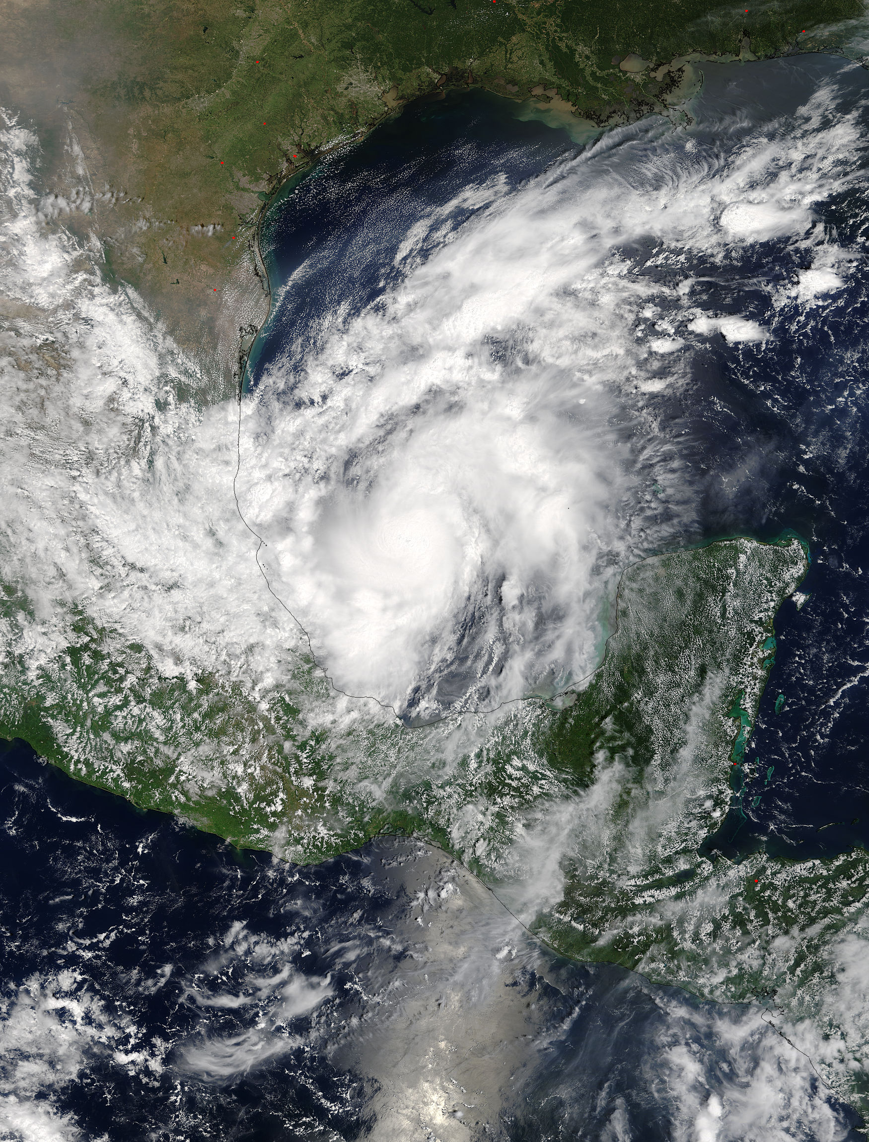
Another NASA update today follows Hurricane Katia as it crawls to the coast of southeastern Mexico. The Moderate Resolution Imaging Spectroradiometer (MODIS) instrument on NASA's Terra satellite tracked powerful bands of thunderstorms near the storm's center yesterday (Sept. 7), but its eye was not visible.
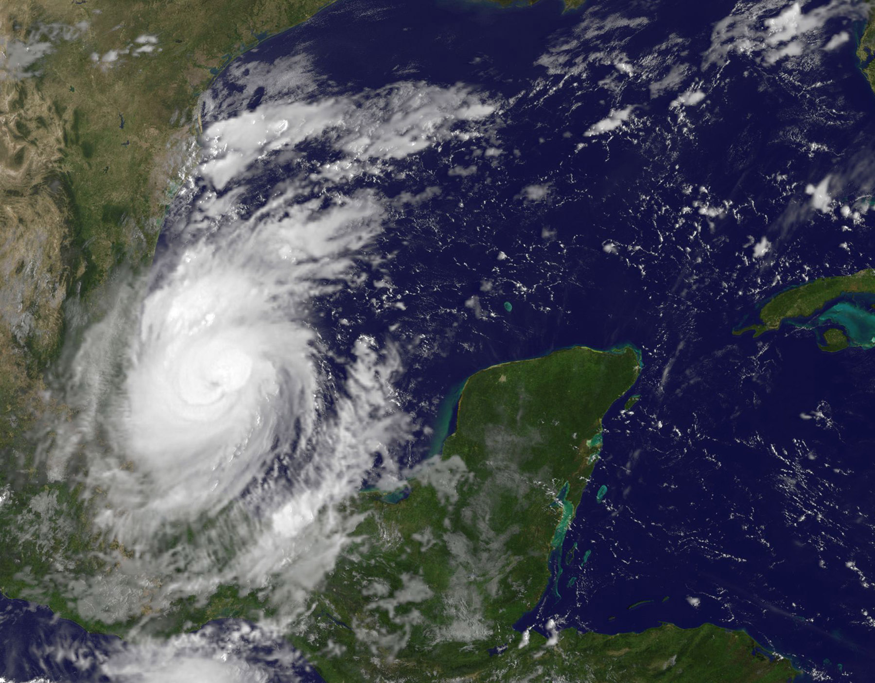
This morning, NOAA's GOES East satellite spotted the beginnings of an eye. Katia is beginning to move southwest at about 5 mph (8 km/h) according to NOAA, and it's expected to make landfall Saturday (Sept. 9).
Email Sarah Lewin at slewin@space.com or follow her @SarahExplains. Follow us @Spacedotcom, Facebook and Google+. Original article on Space.com.
Breaking space news, the latest updates on rocket launches, skywatching events and more!
Join our Space Forums to keep talking space on the latest missions, night sky and more! And if you have a news tip, correction or comment, let us know at: community@space.com.

Sarah Lewin started writing for Space.com in June of 2015 as a Staff Writer and became Associate Editor in 2019 . Her work has been featured by Scientific American, IEEE Spectrum, Quanta Magazine, Wired, The Scientist, Science Friday and WGBH's Inside NOVA. Sarah has an MA from NYU's Science, Health and Environmental Reporting Program and an AB in mathematics from Brown University. When not writing, reading or thinking about space, Sarah enjoys musical theatre and mathematical papercraft. She is currently Assistant News Editor at Scientific American. You can follow her on Twitter @SarahExplains.
